


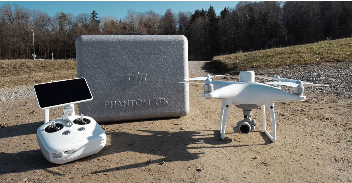
Unleash Precision Aerial Surveying with DJI Phantom4 RTK
When it comes to high-performance drone technology for surveying and mapping, the DJI Phantom4 RTK is the King. This exceptional drone is packed with features that empower professionals to capture data with unparalleled accuracy and efficiency.
Key Features:
- Advanced Camera System: The DJI Phantom4 RTK is equipped with a high-performance camera that supports 20 MP stills and 4K videos. Its mechanical shutter eliminates rolling shutter distortion, ensuring crystal-clear images and videos even at high speeds or in challenging lighting conditions. The 1-inch, 20-megapixel CMOS sensor and custom-engineered lens deliver exceptional image quality.
- Centimeter-Level Precision: Achieve real-time, centimeter-level positioning data with the DJI Phantom4 RTK. It utilizes the D-RTK 2 Mobile Station, NTRIP, or custom network RTK for precise positioning. With support for multiple satellite systems, including GPS, GLONASS, BeiDou, and Galileo, you can rely on superior reliability and accuracy.
- Intelligent Flight Control: Seamlessly plan and control your drone missions using the DJI GS RTK app. This user-friendly application offers various mapping modes, including Photogrammetry, Waypoint Flight, Terrain Awareness, and Block Segmentation. Generate 2D and 3D reconstructions in real time and receive quality reports for each flight.
- SDK Remote Controller: The DJI Phantom4 RTK‘s SDK remote controller is compatible with third-party applications, allowing for customized and automated drone operations. With an impressive battery life of up to five hours, it features essential ports like HDMI, a Micro SD card slot, a microphone, and a speaker.
- Durable and Safe Design: Designed to withstand demanding environments, the DJI Phantom4 RTK features a robust airframe and quick-release propellers. Front and rear obstacle avoidance sensors enhance flight safety, ensuring you can confidently navigate challenging terrain. Compatible with drtk 2 base station
Elevate Your Surveying and Mapping Efforts:
The DJI Phantom4 RTK isn’t just a drone; it’s a precision instrument that empowers surveyors, mappers, and professionals across various industries. Here’s how it can help you achieve your expectations:
- Surveying Excellence: Capture highly accurate data for land surveying, construction site monitoring, and topographic mapping. The centimeter-level precision ensures your measurements are spot on.
- Efficient Mapping: Streamline your mapping projects with intelligent flight planning and real-time reconstructions. Say goodbye to time-consuming manual work.
- Customized Operations: Tailor your drone operations to your specific needs with third-party applications and SDK integration. Achieve automation and efficiency like never before.
- Reliability in Any Environment: Trust in the DJI Phantom4 RTK‘s durability and safety features to deliver results in challenging conditions, whether it’s a construction site, agricultural field, or infrastructure inspection.
Elevate your aerial surveying and mapping game with the DJI Phantom4 RTK. Precision, efficiency, and reliability come together to redefine what’s possible in your industry. It’s time to take your projects to new heights.
Unlock Precision Surveying with DJI Phantom4 RTK – Where Accuracy Meets Efficiency.
In The Box:
Aircraft with RTK-1
Remote Controller with HD Display -1
16 GB Micro SD Card -1
Propellor Blades -4 pairs
Intelligent Flight Battery -2
Remote Controller Intelligent Battery -1
Intelligent Battery Charging Hub -1
Intelligent Flight Battery Charging Hub –1
Gimbal Clamp -1
AC Power Cable -1
AC Power Adapter -1
Micro USB Cable -1
USB Type-C Cable -1
USB Type-C OTG Cable -1
Philips Screw -2
Reviews
Clear filtersThere are no reviews yet.