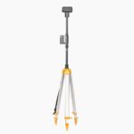


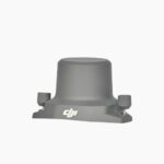
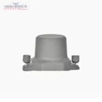


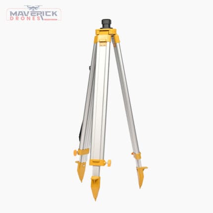
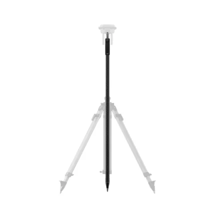
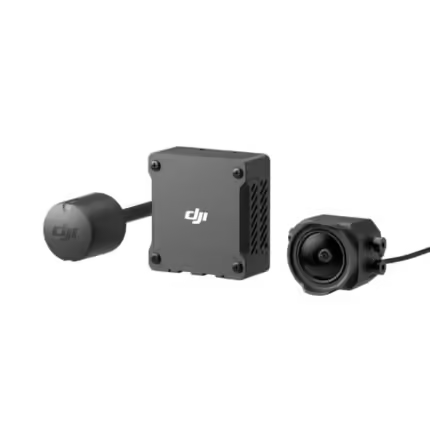
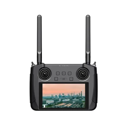
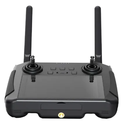
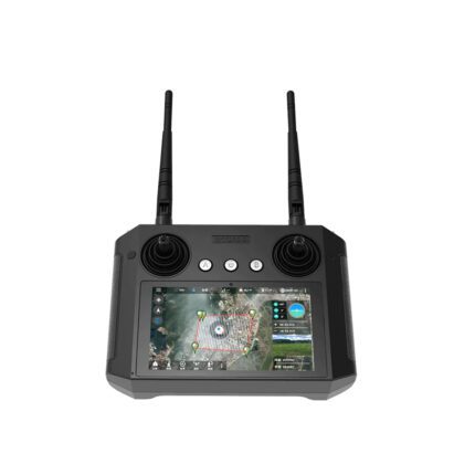
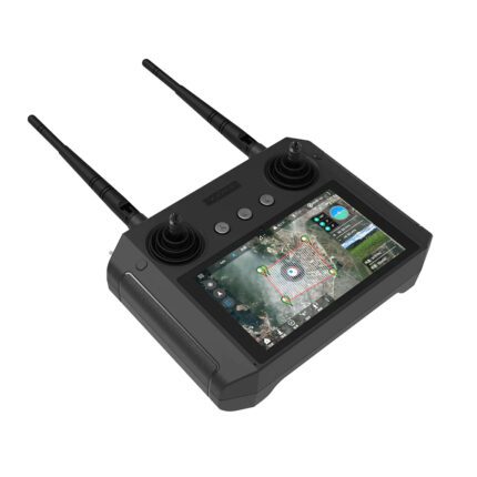
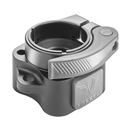
DJI Mavic 3 Enterprise Series RTK Module
₹46,640.00
Applications:
1. Surveying
2. Mapping
3. Inspection
4. Agriculture
And many more…
4 in stock
- 7 Days Return, Exchange & Refund Policy.
- Free Delivery within 3 to 5 Days.
- Assured Product Quality. We deal with only Genuine Products.
- Peace of mind Warranty. Check Our Warranty Policy.
- Contact Us for Any Assistance.
Guaranteed Safe Checkout
DJI Mavic 3 Enterprise Series RTK Module: Elevating Drone Precision
The DJI Mavic 3 Enterprise Series RTK-Module has set a new standard in drone technology, particularly with the introduction of the DJI-Mavic-3-Enterprise Series RTK-Module. This innovative addition enhances the drone's capabilities, offering professionals the precision they need for various applications. In this product description, we’ll delve into the key features, pricing, and benefits of the Mavic 3 RTK Module, while answering some of the most frequently asked questions.
VISIT THIS CATEGORY PAGE TO EXPLORE THE DJI ACCESSORIES.
What Is The DJI Mavic 3 Enterprise Series RTK Module?
The DJI Mavic 3 Enterprise Series RTK Module represents a significant advancement in drone technology, specifically tailored for professionals who demand high precision in their aerial operations. This RTK (Real-Time Kinematic) module integrates seamlessly with the DJI-Mavic-3-Enterprise, elevating its capabilities to deliver centimeter-level accuracy in positioning.
How Does The RTK Module Work?
The DJI Mavic 3 Enterprise Series RTK-Module employs a sophisticated combination of satellite navigation and ground station technology. Here’s a breakdown of its operational mechanics:
- Satellite Signals: The RTK system uses multiple satellites to triangulate the drone's position. By receiving signals from these satellites, the module can determine its exact location with high precision.
- Base Stations: To enhance accuracy further, this RTK Module For Drone can connect to a nearby base station that provides correction data. This station is typically positioned at a known location, allowing it to transmit real-time adjustments to the drone’s GPS signals.
- Post-Processing: In some scenarios, users may also employ post-processing techniques, where collected data is analyzed and refined using software to ensure maximum accuracy.
Applications Of The DJI Mavic 3 Enterprise Series RTK Module
The integration of the RTK-module into the DJI-Mavic-3-Enterprise (named DJI Mavic 3 Enterprise Series RTK-Module) significantly broadens its application scope, making it a versatile tool for various industries. Below, we explore some key applications in more detail:
Surveying
The Mavic 3 RTK Module is particularly beneficial for land surveyors, allowing them to perform tasks such as:
- Topographical Surveys: Drones equipped with the RTK Module can quickly capture elevation data across large areas, creating accurate terrain models. This is essential for land development projects, as it provides insights into land contours and potential drainage issues.
- Boundary Mapping: Precise positioning aids in determining property lines with high accuracy, making it easier for surveyors to resolve disputes or establish clear boundaries for new developments.
- Construction Site Analysis: By regularly surveying construction sites, project managers can monitor progress, identify deviations from plans, and make data-driven decisions that ensure project efficiency and adherence to timelines.
Mapping
In the realm of Geographic Information Systems (GIS), the DJI Mavic 3 Enterprise Series RTK-Module excels in producing highly detailed maps. Its applications include:
- Urban Planning: City planners can utilize accurate aerial data to create updated maps of urban areas, assessing land use, zoning, and infrastructure development needs. The high-resolution imagery aids in visualizing potential changes and impacts on communities.
- Environmental Monitoring: This RTK Module For Drone allows for effective monitoring of ecosystems, helping researchers assess land use changes, track deforestation, and monitor the health of natural resources. This data is crucial for conservation efforts and policy-making.
- Infrastructure Development: Accurate mapping supports the planning and management of infrastructure projects, from transportation networks to utilities. It helps in analyzing routes, assessing potential impacts, and optimizing resource allocation.
Inspection
The DJI Mavic 3 Enterprise Series RTK Module is invaluable in conducting thorough inspections across various infrastructure sectors, including:
- Bridges: Drones can perform detailed inspections of bridge structures, identifying signs of wear, structural issues, or maintenance needs. The ability to collect precise data allows engineers to prioritize repairs and enhance safety measures.
- Power Lines: Inspecting power lines is critical for maintaining energy infrastructure. The Mavic 3, equipped with the RTK Module, can quickly survey extensive networks, detecting issues such as vegetation encroachment or hardware degradation that could lead to outages.
- Wind Turbines: Regular inspections of wind turbine installations can prevent costly downtime. The RTK-Module provides accurate data on the condition of turbine blades and associated infrastructure, enabling timely maintenance and operational efficiency.
Agriculture
In the agricultural sector, the DJI Mavic 3 Enterprise Series RTK Module enhances precision farming techniques, allowing farmers to:
- Monitor Crop Health: Farmers can collect detailed aerial imagery to assess crop health, identify pest infestations, and evaluate nutrient deficiencies. This data enables targeted interventions, promoting sustainable farming practices.
- Optimize Resource Usage: By analyzing data collected from the air, farmers can make informed decisions about irrigation, fertilization, and pesticide application, ensuring resources are used efficiently and effectively.
- Field Mapping: Accurate mapping allows for better planning and management of planting patterns, crop rotations, and field layouts, ultimately improving yield and profitability.
Compatibility Of The DJI Mavic-3-Enterprise Series RTK Module
The Mavic 3 RTK-Module is meticulously engineered for seamless integration with the DJI Mavic 3 Enterprise, providing users with a straightforward way to enhance their drone's capabilities. This compatibility is crucial for professionals seeking to leverage advanced technology without the complexities often associated with retrofitting or modifying equipment. Here’s a closer look at the features and benefits of this compatibility:
Plug-and-Play Design
This RTK Module For Drone is designed with user convenience in mind. It features a plug-and-play installation process, meaning users can attach it to the drone without needing specialized tools or technical expertise. This simplicity ensures that operators can quickly switch between standard flight operations and RTK-enabled missions, optimizing workflow efficiency.
Integrated Functionality
Once installed, the DJI Mavic 3 Enterprise Series RTK-Module works in tandem with the drone's existing systems. Key functionalities include:
- Real-Time Positioning: The RTK-module enhances the Mavic-3-Enterprise product’s GNSS (Global Navigation Satellite System) capabilities, allowing for real-time corrections and providing centimeter-level accuracy in positioning.
- Data Synchronization: This DJI RTK Module ensures that the data collected during flights is synchronized with the drone’s other sensors, such as cameras and LiDAR systems. This integration allows for seamless data collection and analysis, which is particularly useful for surveying and mapping applications.
Firmware and Software Compatibility
The RTK-module is fully compatible with the DJI Pilot app, which serves as the primary interface for controlling the Mavic 3 Enterprise. Users can access advanced flight modes, customize settings, and monitor RTK status through the app, ensuring a cohesive user experience. Regular firmware updates from DJI further enhance compatibility and functionality, ensuring that users benefit from the latest technological advancements.
Support for Multiple Applications
The compatibility of the Mavic 3 RTK Module with the DJI Mavic 3 Enterprise Series RTK-Module extends to a wide range of applications, including:
- Surveying and Mapping: The ability to integrate precise positioning into mapping workflows enables surveyors and GIS professionals to collect highly accurate geospatial data quickly.
- Inspection and Monitoring: This DJI RTK Module supports detailed inspections of infrastructure, providing the accuracy needed for thorough assessments while integrating easily into existing workflows.
- Agricultural Applications: Farmers can enhance their precision farming practices using the RTK-module, allowing for better management of crops and resources without needing to invest in additional equipment.
Future-Proofing Capabilities
As technology continues to evolve, the Mavic 3 RTK Module product’s compatibility with the DJI Mavic 3 Enterprise Series RTK-Module positions users to take advantage of future upgrades and enhancements. With DJI’s commitment to ongoing development and support, users can expect continuous improvements that will enhance the capabilities of both the drone and the RTK-module.
What Is The RTK GPS Module?
The RTK GPS Module in the DJI-Mavic-3-Enterprise is a cutting-edge positioning system designed to provide users with highly accurate geolocation data. Leveraging advanced satellite technology, this module is essential for various applications that demand precision, such as surveying, mapping, and inspections. Are you looking for the latest RTK Price? If yes, contact our sales team to receive the best rate.
Why Choose A DJI RTK Drone?
Choosing a DJI-RTK-Drone, such as the Mavic 3 Enterprise, provides a multitude of advantages that enhance both operational efficiency and data accuracy across various professional applications. Here’s an in-depth look at the benefits of selecting a DJI RTK Drone.
High Accuracy
One of the standout features of DJI RTK drones is their exceptional accuracy. Here’s how they achieve this:
- Centimeter-Level Precision: The integration of RTK technology allows these drones to provide positioning accuracy within a few centimeters, which is crucial for applications requiring high precision, such as surveying and mapping.
- Real-Time Corrections: By utilizing base stations to send real-time correction data, DJI RTK drones maintain their accuracy during flight, adapting to environmental factors that could affect satellite signals.
- Reduced Errors: The high level of accuracy significantly minimizes errors in data collection, which is essential for industries where even slight deviations can lead to costly mistakes or regulatory issues.
Enhanced Safety Features
DJI RTK drones are equipped with advanced safety features that enhance operational reliability:
- Obstacle Detection: These drones incorporate sophisticated sensors that detect obstacles in real-time, allowing for safer navigation in complex environments. This capability reduces the risk of collisions and enhances operational safety.
- Fail-Safe Mechanisms: In the event of signal loss or battery depletion, DJI drones are designed to execute predefined safety protocols, such as returning to the home point or landing safely. These fail-safes protect both the drone and the surrounding environment.
- Geofencing: Built-in geofencing features restrict drone operations in sensitive or restricted areas, helping users comply with regulations and ensuring safe flight operations.
Reliable Performance
DJI’s long-standing reputation for quality ensures that their RTK drones deliver reliable performance:
- Durability and Design: DJI drones are built with robust materials and advanced engineering, making them durable in various operating conditions. This reliability is essential for professionals working in demanding environments.
- User-Friendly Interface: The DJI Pilot app provides an intuitive user experience, allowing operators to easily navigate settings, monitor flight status, and access real-time data. This ease of use contributes to reduced training time and operational efficiency.
- Comprehensive Support: DJI offers extensive support and resources for their products, including tutorials, forums, and customer service. This support network helps users troubleshoot issues and maximize their drone’s capabilities.
Cost-Effectiveness
While the initial investment in a DJI RTK Drone may be higher compared to non-RTK models, the long-term cost savings can be substantial:
- Time Savings: The ability to quickly gather accurate data reduces the time required for surveys and inspections, leading to faster project completion.
- Reduced Labor Costs: With improved accuracy, there’s less need for additional staff to correct errors or validate data, which can lead to significant savings in labor costs.
- Enhanced Data Utility: High-quality data can lead to better decision-making and project outcomes, reducing the likelihood of costly revisions and rework.
Future-Proofing Your Operations
Investing in a DJI RTK Drone positions professionals to take advantage of future advancements in drone technology:
- Upgradable Features: DJI regularly releases firmware updates and enhancements, ensuring that users can keep their drones up to date with the latest capabilities and features.
- Expanding Applications: As industries evolve, the versatility of RTK drones allows for adaptation to new technologies and methods, ensuring that your investment remains relevant.
What Is The DJI Mavic-3-Enterprise Series RTK Module Price In India?
When considering the DJI Mavic 3 Enterprise Series RTK Module Price In India, it typically varies depending on the retailer and any ongoing promotions. It's essential to check with authorized dealers or the DJI website for the most accurate pricing.
For those looking for the best pricing and exceptional service, Maverick Drones And Technologies Private Limited is a standout choice. They consistently offer competitive prices across India and have built a reputation for excellent customer service over the years. Customers have praised their reliability and responsiveness, making them a trusted partner for drone enthusiasts and professionals alike.
If you're interested in purchasing the DJI Mavic 3 Enterprise Series RTK-Module, consider contacting Maverick Drones And Technologies Private Limited for the best price and quality support. Their commitment to customer satisfaction and positive reviews further solidify them as an outstanding company choice in the drone market.
Additional Details
The DJI Mavic 3 Enterprise Series RTK-Module is a groundbreaking advancement in drone technology, elevating the capabilities of aerial operations to meet the demanding needs of professionals across various industries. With its integration of RTK technology, the Mavic-3-Enterprise provides centimeter-level accuracy, making it an invaluable tool for applications in surveying, mapping, inspection, and agriculture.
The functionality of the RTK Module, powered by sophisticated satellite and base station technology, ensures that users can capture precise geospatial data in real-time. Its seamless compatibility with the Mavic-3-Enterprise means that enhancing your drone's capabilities is straightforward and user-friendly, allowing operators to transition effortlessly between standard and RTK-enabled missions.
In addition to its exceptional accuracy, the DJI Mavic 3 Enterprise Series RTK-Module is equipped with advanced safety features, ensuring reliable performance in various operational environments. Its robust design, user-friendly interface, and comprehensive support from DJI further solidify its position as a leader in the market.
For professionals looking to invest in this cutting-edge technology, the DJI-Mavic-3-Enterprise is competitively priced, with Maverick Drones And Technologies Private Limited being a top choice for purchasing. Their reputation for excellent customer service and commitment to providing the best prices in India makes them a reliable partner for anyone seeking to elevate their drone operations.
Grab This Product Now!
The DJI-Mavic-3-Enterprise Series RTK Module is not just a tool; it’s a gateway to enhanced efficiency, accuracy, and innovation in aerial applications, positioning users at the forefront of the evolving drone technology landscape. Whether you're involved in surveying, agricultural management, infrastructure inspection, or environmental monitoring, this advanced RTK drone equips you with the precision needed to succeed in your field. Are you looking for the latest DJI Mavic 3 Enterprise Price In India? If yes, contact our sales team to receive the best rate.
1. We ship our products all over India within 3-5 working days. This includes all 28 states and 8 Union Territories. We do not offer international shipping at this time. We apologize for any inconvenience caused.
2. We ship our products through our delivery partner Shree Tirupati Courier Services PVT. LTD . (http://www.shreetirupaticourier.net/ ) and DTDC Express LTD. (https://www.dtdc.in/index.asp). Shree Tirupati Courier has over 1500 centers in more than 21 states rest are covered by DTDC and its jargon of GPS-connected trucks.
Once we receive an order before 4 pm and we have received the payment at our bank we can process the order the very same day (if it’s a working day i.e. Monday to Saturday). If however, we receive it after 4 pm then we process the order the next working day.
3. As promised on our product page we will bear the entire charges of shipping to your location.
4. It takes around 3-5 working days to deliver the products anywhere in the country. They ship it via the above-mentioned couriers in the surface transit system. However, if you want a quicker delivery you can raise a request by getting in touch with us before placing the order(or within one hour of placing the order) through mail support@mavdrones.com or call us at +91 9330328517 We will arrange Air shipping in that case. You will receive the product within 1-3 working days in that case.
5. After shipping we will give you the tracking id within 2 hours of shipping. In case we ship through Shree Tirupati Courier then you can visit http://www.shreetirupaticourier.net/Frm_DocTrack.aspx?docno=%number% This page of them and put your tracking id and can get real-time updates through this tracking platform. However, if we ship through DTDC Express then you need to visit https://www.dtdc.in/tracking.asp for tracking shipping updates.
6. We have several options for sending you the tracking id i.e. we can send it in the mail, WhatsApp, or telegram.
7. If you have any problems with the delivery like:
7A. Delayed shipment: If the shipment is delayed by any chance of any more than 3-5 working days then you have the right to demand a full refund which will be processed as per our refund policy which you can see at our RETURNS< EXCHANGES AND REFUNDS POLICY or if you are willing to cooperate with us then we can enquire with the shipping company and try and find out why the delay is happening. In the latter case, we can either work with the shipping company and try and deliver the transiting item as soon as possible or we can ship a new product to your location through a different courier partner.
7B. Receiving a broken item: We strongly suggest you should make an unboxing video of the product and also keep recording till you successfully fly the drone. Therefore, if you receive a broken item we can identify it from the video and can process a RETURN, EXCHANGE, or Refund as per your wish.
8. Public Holidays and Force Majeure:
Please note that the delivery timeframe may be affected during public holidays and unforeseen circumstances beyond our control (Such as natural disasters, strikes, or transportation disruptions). We appreciate your understanding in such situations.


Reviews
Clear filtersThere are no reviews yet.