
Pix4DFields
₹411,967.50 Incl. GST. Claimable with B2B Billing.
Specifications:
- Precision Mapping
- Real-Time Insights
- Advanced Analytics
- User-Friendly Interface
- Flexible Output Formats
And many more…
- 7 Days Return, Exchange & Refund Policy.
- Free Delivery within 3 to 5 Days.
- Assured Product Quality. We deals with only Genuine Products.
- Peace of mind Warranty. Check Our Warranty Policy.
- Contact Us for Any Assistance.
Guaranteed Safe Checkout
Pix4DFields: Revolutionizing Agricultural Mapping With Precision And Efficiency
Introducing Pix4DFields, the leading Drone Software For Agriculture designed to transform how you manage and monitor your crops. Leveraging cutting-edge technology, Pix4D-Fields provides highly accurate and actionable insights, enabling farmers, agronomists, and agricultural consultants to optimize their practices and increase productivity. This comprehensive Drone Agriculture Mapping Software offers powerful tools for field mapping, crop monitoring, and data analysis, making it the Best Agriculture Drone Software available today.
THIS PIX4DFIELDS IS COMPATIBLE WITH THE DJI MAVIC 3 MULTISPECTRAL – MAVIC 3M DRONE AGRICULTURE SOLUTION. VISIT THIS CATEGORY PAGE TO EXPLORE MORE SUCH PRODUCTS.
Pix4DFields: Key Features
- Precision Mapping: Pix4DFields excels in creating precise and detailed maps of your fields. It captures high-resolution images and converts them into accurate maps that highlight various crop metrics and health indicators.
- Real-Time Insights: With Pix4DFields, you can process images in the field and get instant insights. This capability allows you to make timely decisions that can significantly impact crop health and yield.
- Advanced Analytics: The software provides robust analytical tools to measure and evaluate crop performance. You can analyze data on plant health, soil conditions, and more to identify areas that need attention.
- User-Friendly Interface: Designed with ease of use in mind, Pix4DFields offers an intuitive interface that simplifies the mapping and analysis process. Whether you are a seasoned professional or a newcomer to Drone Software For Agriculture, you’ll find it easy to navigate and use.
- Flexible Output Formats: Export your maps and data in various formats compatible with other agricultural software and tools. This flexibility ensures that you can integrate Pix4DFields into your existing workflow seamlessly.
Pix4DFields: Answering Your Questions
What Is The Difference Between PIX4DFields And PIX4DMapper?
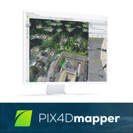
While both PIX4DFields and PIX4DMapper are powerful tools from Pix4D, they serve different purposes and are optimized for specific applications. PIX4DMapper is a versatile photogrammetry software designed for a wide range of mapping and surveying tasks, making it suitable for industries such as construction, mining, and environmental monitoring. This Pix4d Agriculture software offers detailed customization options and high precision for various mapping projects.
PIX4DFields, on the other hand, is specialized for agriculture. It is optimized for processing agricultural data and providing actionable insights tailored to crop management. Pix4d Fields focuses on delivering real-time results and easy-to-understand analytics that help farmers and agronomists make informed decisions. Its features are specifically designed to address the unique challenges and requirements of agricultural mapping and crop monitoring.
Pix4DFields Pricing
Pix4DFields Pricing is designed to be flexible and affordable, catering to the needs of different users. Whether you are a small-scale farmer or part of a large agricultural enterprise, there is a pricing plan that fits your requirements and budget. The fair Pix4dfields Price makes this product worth buying.
Pix4DFields: Download And Accessibility
Getting started with Pix4DFields is straightforward. Simply visit the Pix4D website for Pix4DFields Download and start your free trial. The installation process is quick and easy, allowing you to begin mapping your fields without delay. Pix4d Fields is compatible with various drone models and supports both Windows and macOS, ensuring accessibility for a wide range of users.
Pix4DFields: Enhanced Productivity And Collaboration
Pix4DFields enhances productivity by providing real-time data processing and insights, allowing for immediate action in the field. This Drone Software For Agriculture Mapping's cloud integration enables seamless data sharing and collaboration among team members and stakeholders, ensuring that everyone has access to the most up-to-date information. This feature is particularly valuable for large farming operations that require coordinated efforts across multiple locations and teams.
Comparing Pix4DFields Vs Other Agriculture Mapping Software
When comparing Pix4DFields to other Drone Agriculture Mapping Software, its advanced features and real-time capabilities stand out. Pix4D-Fields offers faster processing times, higher accuracy, and more detailed analytics than many competitors, making it the preferred choice for precision agriculture. Its user-friendly interface and robust toolset provide a comprehensive solution for all your agricultural mapping needs.
Pix4DFields: Compatibility With Mavic 3 Multispectral Drone
Pix4DFields is fully compatible with the Mavic 3 Multispectral Drone, making it an ideal choice for agricultural professionals seeking advanced mapping and analysis capabilities. The Mavic 3 Multispectral Drone captures high-resolution multispectral images that Pix4D-Fields can seamlessly process and analyze. This integration allows for precise crop health monitoring, soil analysis, and more, ensuring that you get the most accurate and actionable insights from your aerial data. With Pix4d Fields and the Mavic 3 Multispectral Drone, you can elevate your agricultural operations to new heights of efficiency and effectiveness.
Pix4DFields: Purchase This Product Now
Pix4DFields is the ultimate Drone Software For Agriculture, providing the tools and insights needed to optimize crop management and increase productivity. With its advanced mapping capabilities, real-time data processing, and user-friendly interface, Pix4D-Fields is the Best Agriculture Drone Software available today. Whether you are involved in crop scouting, precision farming, or agricultural research, Pix4D-Fields offers the precision and efficiency you need to achieve better results.
1. We ship our products all over India within 3-5 working days. This includes all 28 states and 8 Union Territories. We do not offer international shipping at this time. We apologize for any inconvenience caused.
2. We ship our products through our delivery partner Shree Tirupati Courier Services PVT. LTD . (http://www.shreetirupaticourier.net/ ) and DTDC Express LTD. (https://www.dtdc.in/index.asp). Shree Tirupati Courier has over 1500 centers in more than 21 states rest are covered by DTDC and its jargon of GPS-connected trucks.
Once we receive an order before 4 pm and we have received the payment at our bank we can process the order the very same day (if it’s a working day i.e. Monday to Saturday). If however, we receive it after 4 pm then we process the order the next working day.
3. As promised on our product page we will bear the entire charges of shipping to your location.
4. It takes around 3-5 working days to deliver the products anywhere in the country. They ship it via the above-mentioned couriers in the surface transit system. However, if you want a quicker delivery you can raise a request by getting in touch with us before placing the order(or within one hour of placing the order) through mail support@www.mavdrones.com or call us at +91 9330328517 We will arrange Air shipping in that case. You will receive the product within 1-3 working days in that case.
5. After shipping we will give you the tracking id within 2 hours of shipping. In case we ship through Shree Tirupati Courier then you can visit http://www.shreetirupaticourier.net/Frm_DocTrack.aspx?docno=%number% This page of them and put your tracking id and can get real-time updates through this tracking platform. However, if we ship through DTDC Express then you need to visit https://www.dtdc.in/tracking.asp for tracking shipping updates.
6. We have several options for sending you the tracking id i.e. we can send it in the mail, WhatsApp, or telegram.
7. If you have any problems with the delivery like:
7A. Delayed shipment: If the shipment is delayed by any chance of any more than 3-5 working days then you have the right to demand a full refund which will be processed as per our refund policy which you can see at our RETURNS< EXCHANGES AND REFUNDS POLICY or if you are willing to cooperate with us then we can enquire with the shipping company and try and find out why the delay is happening. In the latter case, we can either work with the shipping company and try and deliver the transiting item as soon as possible or we can ship a new product to your location through a different courier partner.
7B. Receiving a broken item: We strongly suggest you should make an unboxing video of the product and also keep recording till you successfully fly the drone. Therefore, if you receive a broken item we can identify it from the video and can process a RETURN, EXCHANGE, or Refund as per your wish.
8. Public Holidays and Force Majeure:
Please note that the delivery timeframe may be affected during public holidays and unforeseen circumstances beyond our control (Such as natural disasters, strikes, or transportation disruptions). We appreciate your understanding in such situations.


Reviews
Clear filtersThere are no reviews yet.