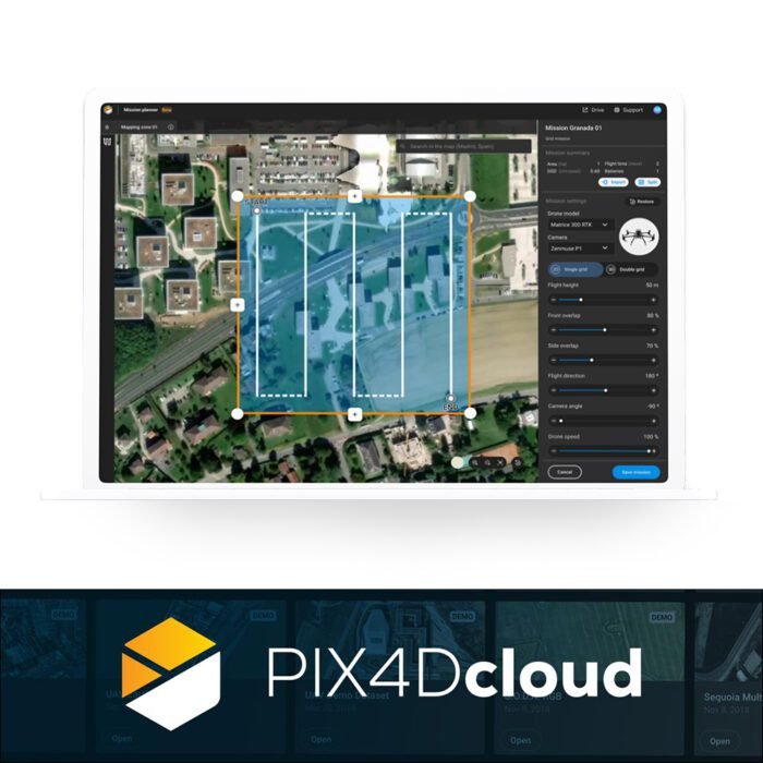
Pix4DCloud
₹308,717.00
Specifications:
- Cloud-Based Processing
- Real-Time Collaboration
- Automated Workflows
- Scalability
And many more…
- 7 Days Return, Exchange & Refund Policy.
- Free Delivery within 3 to 5 Days.
- Assured Product Quality. We deal with only Genuine Products.
- Peace of mind Warranty. Check Our Warranty Policy.
- Contact Us for Any Assistance.
Guaranteed Safe Checkout
Pix4D Cloud: Revolutionize Your Aerial Data Processing
Overview
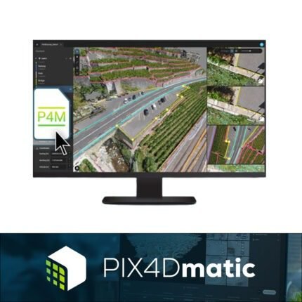
The Pix4D Cloud is a cutting-edge cloud-based platform designed for the processing, analysis, and sharing of aerial imagery and data. Ideal for professionals in surveying, construction, agriculture, and other industries, Pix4DCloud streamlines the workflow of converting raw aerial images into accurate, detailed 2D maps and 3D models. This platform leverages advanced photogrammetry technology, ensuring high precision and reliability.
VISIT THIS CATEGORY PAGE TO EXPLORE MORE SUCH PRODUCTS. CHECK OUT THIS RELATED SOFTWARE. THESE ARE COMPATIBLE WITH THIS PIX4DCLOUD: DJI MAVIC 3 ENTERPRISE AND DJI MAVIC 3 THERMAL – MAVIC 3T WORRY FREE – BASIC COMBO.
Pix4D Cloud: Key Features
- Cloud-Based Processing: With Pix4D Cloud, you can upload your aerial data directly to the cloud, where it is processed into comprehensive maps and models. This eliminates the need for powerful local hardware and accelerates project timelines.
- Real-Time Collaboration: Share your maps and models with team members and stakeholders in real-time. The Cloud Pix4d platform facilitates seamless collaboration, making it easier to coordinate and communicate across different locations.
- Automated Workflows: Pix4D Cloud automates many of the labor-intensive tasks involved in aerial data processing, allowing you to focus on analysis and decision-making. This includes automatic generation of Pix4D Point Cloud data, orthomosaics, and digital surface models (DSMs).
- Scalability: Whether you are handling small projects or large-scale operations, Pix4DCloud scales to meet your needs. It offers flexible storage and processing capabilities, ensuring you can manage vast amounts of data efficiently.
Pix4D Cloud: Answering Your Questions
What Is PIX4DCloud?
Pix4D Cloud is a cloud-based platform designed for the processing and analysis of aerial imagery. It allows users to upload raw images captured by drones or other aerial devices, which are then processed into detailed 2D maps and 3D models. This platform is widely used in industries such as construction, surveying, and agriculture for its precision and ease of use.
Can You Use Pix4D For Free?
Pix4D Cloud offers a range of subscription plans, including a free trial period that allows users to explore its capabilities. While the free trial provides limited access to the platform's features, it gives users a good overview of its functionality. For full access to all features and capabilities, subscribing to one of the paid plans is necessary.
What Is Pix4D Used For?
Pix4D Cloud is used for transforming aerial imagery into precise maps and models. It is widely utilized throughout several sectors, including:
- Construction: For project management, progress monitoring, as well as site assessments.
- Surveying: For generating accurate topographic maps and 3D terrain models.
- Agriculture: For crop monitoring, health assessment, and precision farming.
- Mining: For volume measurement and site planning.
- Inspection: For infrastructure assessment and maintenance planning.
What Is The Difference Between PIX4Dmapper And Pix4DCloud?
The main difference between PIX4Dmapper and Pix4D Cloud lies in their processing environments. PIX4Dmapper is a desktop application that processes data locally on your computer, providing full control over the processing settings and outputs. In contrast, Pix4DCloud is a cloud-based solution that processes data online, offering convenience and scalability. While both tools provide robust photogrammetry capabilities, Pix4DCloud excels in ease of access and collaboration features.
Why Choose Pix4D Cloud?
Pix4D Cloud stands out as a leading solution for aerial data processing due to its advanced features, user-friendly interface, and robust performance. Professionals in a variety of sectors can benefit from its unmatched efficiency and ease thanks to its utilization of cloud technology. Whether you need to generate accurate maps, collaborate with remote teams, or scale your operations, Pix4DCloud is the ideal choice.
Pix4D Cloud Pricing
Pix4D Cloud Pricing is designed to be flexible and cater to different needs and budgets. There are various subscription plans available, from entry-level options for small projects to comprehensive plans for large enterprises. The exact cost will depend on the specific requirements and the scale of your operations.
Pix4D Cloud: Enhanced Collaboration And Efficiency
One of the standout features of Pix4D Cloud is its ability to enhance collaboration and efficiency across teams. By providing a centralized platform for data processing and sharing, it ensures that all stakeholders have access to the most up-to-date information. This facilitates better cooperation and expedites the process of making decisions.
Pix4D Cloud: Scalability For Growing Needs
As your projects grow, so do your data processing needs. Pix4D Cloud is designed to scale effortlessly, accommodating increased data volumes and more complex processing tasks. This scalability ensures that you can continue to rely on the platform, no matter how large or small your projects become.
Pix4D Cloud: Compatibility With Mavic 3 Series Drones
Pix4D Cloud is fully compatible with the Mavic 3 Enterprise, Mavic 3 Thermal, and Mavic 3 Multispectral drones, making it a versatile choice for a wide range of aerial imaging and data processing needs. Whether you are utilizing the high-resolution imagery of the Mavic 3 Enterprise, the thermal imaging capabilities of the Mavic 3 Thermal, or the multispectral data from the Mavic 3 Multispectral, Pix4DCloud provides a comprehensive platform for processing and analyzing your data. This integration allows for seamless uploading, processing, and sharing of your aerial data, enabling efficient and accurate analysis across various applications, including construction, agriculture, and thermal inspections. With Pix4DCloud, you can maximize the potential of your Mavic 3 drones, ensuring optimal results and streamlined workflows.
Pix4D Cloud: Purchase This Product Right Now
The Pix4D Cloud platform is a game-changer for professionals needing reliable, efficient, and precise aerial data processing. Its advanced cloud-based capabilities, combined with flexible pricing options and robust performance, make it the ultimate choice for transforming raw imagery into actionable insights. Explore the power of Pix4DCloud today and take your projects to new heights. The fair Pix4dcloud Pricing of this product makes it worth buying.
1. We ship our products all over India within 3-5 working days. This includes all 28 states and 8 Union Territories. We do not offer international shipping at this time. We apologize for any inconvenience caused.
2. We ship our products through our delivery partner Shree Tirupati Courier Services PVT. LTD . (http://www.shreetirupaticourier.net/ ) and DTDC Express LTD. (https://www.dtdc.in/index.asp). Shree Tirupati Courier has over 1500 centers in more than 21 states rest are covered by DTDC and its jargon of GPS-connected trucks.
Once we receive an order before 4 pm and we have received the payment at our bank we can process the order the very same day (if it’s a working day i.e. Monday to Saturday). If however, we receive it after 4 pm then we process the order the next working day.
3. As promised on our product page we will bear the entire charges of shipping to your location.
4. It takes around 3-5 working days to deliver the products anywhere in the country. They ship it via the above-mentioned couriers in the surface transit system. However, if you want a quicker delivery you can raise a request by getting in touch with us before placing the order(or within one hour of placing the order) through mail support@mavdrones.com or call us at +91 9330328517 We will arrange Air shipping in that case. You will receive the product within 1-3 working days in that case.
5. After shipping we will give you the tracking id within 2 hours of shipping. In case we ship through Shree Tirupati Courier then you can visit http://www.shreetirupaticourier.net/Frm_DocTrack.aspx?docno=%number% This page of them and put your tracking id and can get real-time updates through this tracking platform. However, if we ship through DTDC Express then you need to visit https://www.dtdc.in/tracking.asp for tracking shipping updates.
6. We have several options for sending you the tracking id i.e. we can send it in the mail, WhatsApp, or telegram.
7. If you have any problems with the delivery like:
7A. Delayed shipment: If the shipment is delayed by any chance of any more than 3-5 working days then you have the right to demand a full refund which will be processed as per our refund policy which you can see at our RETURNS< EXCHANGES AND REFUNDS POLICY or if you are willing to cooperate with us then we can enquire with the shipping company and try and find out why the delay is happening. In the latter case, we can either work with the shipping company and try and deliver the transiting item as soon as possible or we can ship a new product to your location through a different courier partner.
7B. Receiving a broken item: We strongly suggest you should make an unboxing video of the product and also keep recording till you successfully fly the drone. Therefore, if you receive a broken item we can identify it from the video and can process a RETURN, EXCHANGE, or Refund as per your wish.
8. Public Holidays and Force Majeure:
Please note that the delivery timeframe may be affected during public holidays and unforeseen circumstances beyond our control (Such as natural disasters, strikes, or transportation disruptions). We appreciate your understanding in such situations.





Reviews
Clear filtersThere are no reviews yet.