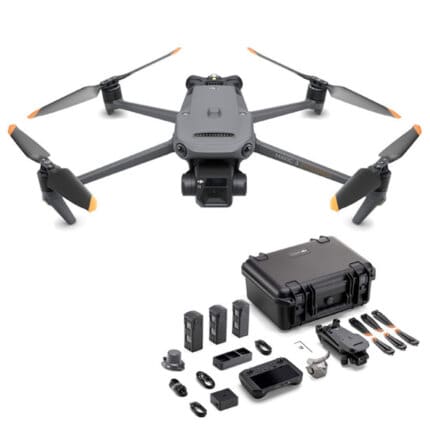
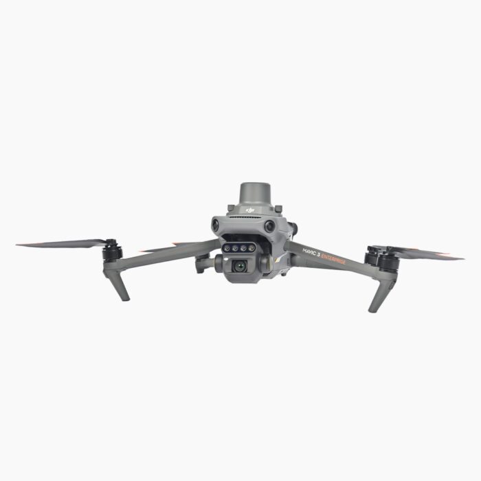
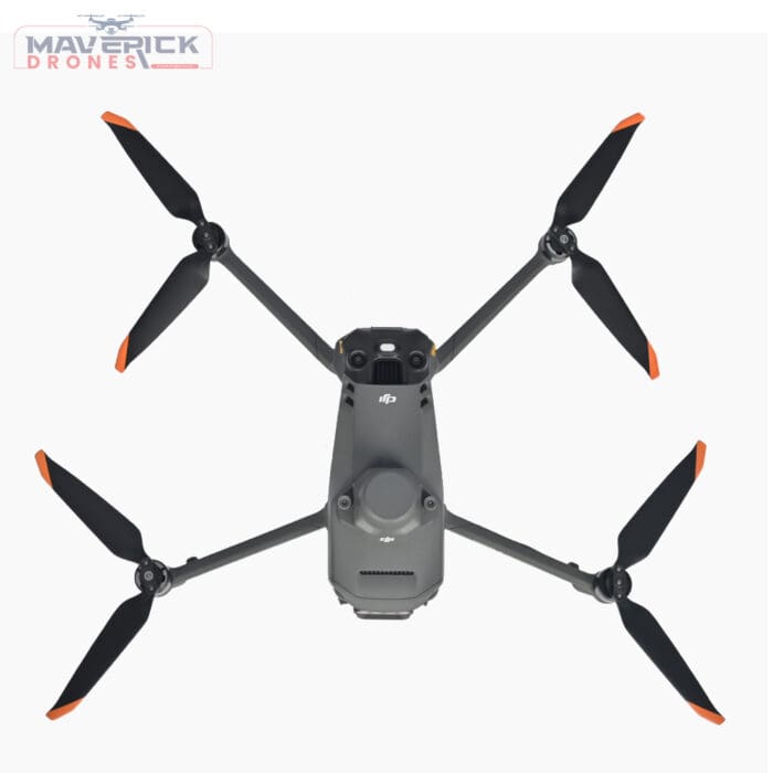
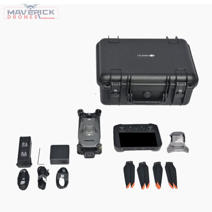
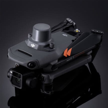
DJI Mavic 3 Multispectral – DJI Mavic 3M Drone Agriculture Solution
₹578,200.00
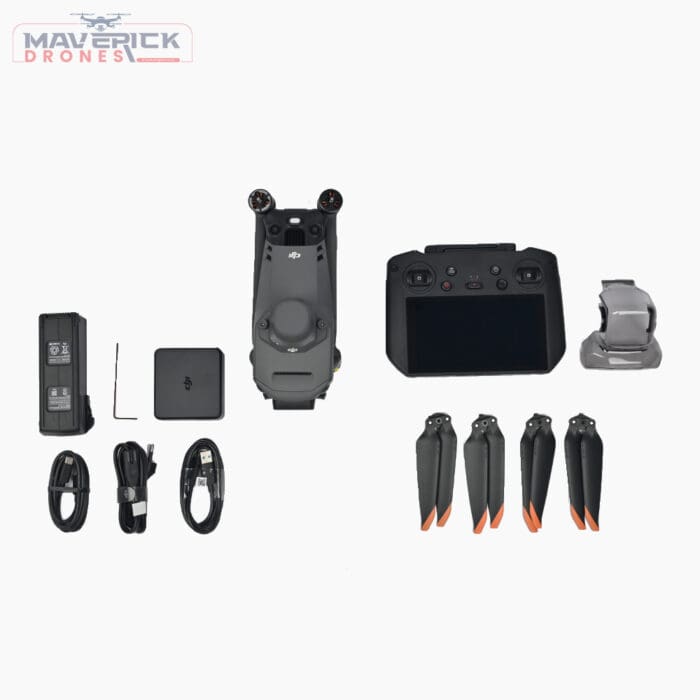
Technical Specifications Of The DJI Mavic 3 Multispectral (DJI Mavic 3M)-
Net Weight (with propellers and RTK module): 951 g
Max Takeoff Weight: 1,050 g
Dimensions (Folded): 223×96.3×122.2 mm (Length×Width×Height)
Dimensions (Unfolded): 347.5×283×139.6 mm (Length×Width×Height)
Diagonal Length: 380.1 mm
Max Ascent Speed: 6 m/s (Normal Mode), 8 m/s (Sport Mode)
Max Descent Speed: 6 m/s (Normal Mode), 6 m/s (Sport Mode)
Max Flight Speed (at sea level, no wind): 15 m/s (Normal Mode), 21 m/s (Sport Mode – forward), 20 m/s (sideways), 19 m/s (backwards)
Max Wind Speed Resistance: 12 m/s
4 in stock
- 7 Days Return, Exchange & Refund Policy.
- Free Delivery within 3 to 5 Days.
- Assured Product Quality. We deals with only Genuine Products.
- Peace of mind Warranty. Check Our Warranty Policy.
- Contact Us for Any Assistance.
Guaranteed Safe Checkout
See Beyond The Horizon With DJI Mavic 3 Multispectral
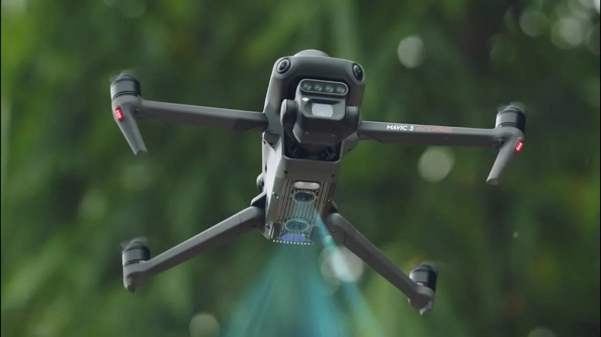
Imagine a drone that doesn’t just fly – it sees the world in ways no other can. Enter the DJI Mavic 3 Multispectral – the sky's first true “data detective”. This isn’t your average drone; it’s a high-tech aerial wizard with a multispectral camera that unveils hidden layers of information about the world beneath. From the secret life of crops to the invisible health of the environment, it captures it all with precision and power. Think of it as your eyes in the sky, but sharper, smarter, and capable of flying for up to 43 minutes, covering 32 km of land. Whether you're surveying fields or mapping ecosystems, the DJI Mavic 3M turns data into actionable insights with near-perfect accuracy. Ready to explore a whole new dimension of exploration? This is more than a drone. It’s a revolution in flight.
DJI Mavic 3 Multispectral Technical Specifications
Aircraft Specifications Of DJI Mavic 3M:
Net Weight (with propellers and RTK module): 951 g
Max Takeoff Weight: 1,050 g
Dimensions (Folded): 223×96.3×122.2 mm (Length×Width×Height)
Dimensions (Unfolded): 347.5×283×139.6 mm (Length×Width×Height)
Diagonal Length: 380.1 mm
Max Ascent Speed: 6 m/s (Normal Mode), 8 m/s (Sport Mode)
Max Descent Speed: 6 m/s (Normal Mode), 6 m/s (Sport Mode)
Max Flight Speed (at sea level, no wind): 15 m/s (Normal Mode), 21 m/s (Sport Mode - forward), 20 m/s (sideways), 19 m/s (backwards)
Max Wind Speed Resistance: 12 m/s
Max Take-off Altitude Above Sea Level: 6,000 m (without a payload)
Max Flight Time (without wind): 43 minutes
Max Hover Time (without wind): 37 minutes
Max Flight Distance: 32 km
Max Pitch Angle: 30° (Normal Mode), 35° (Sport Mode)
Max Angular Velocity: 200°/s
GNSS: GPS + Galileo + BeiDou + GLONASS (GLONASS supported with RTK module)
Hovering Accuracy Range: Vertical: ±0.1 m (Vision Positioning enabled), ±0.5 m (GNSS Positioning enabled), ±0.1 m (D-RTK enabled)
Camera Specifications Of DJI Mavic 3M:
RGB Camera
Image Sensor: 4/3 CMOS, 20 MP
Lens: FOV: 84°, Equivalent focal length: 24 mm, Aperture: f/2.8 to f/11
ISO Range: 100-6400
Shutter Speed: 8-1/8000 s (Electronic), 8-1/2000 s (Mechanical)
Max Image Size: 5280×3956
Photo Shooting Mode: Single shot, Timed, JPEG + RAW, Panorama
Video Resolution: 4K: 3840×2160@30fps, FHD: 1920×1080@30fps
Max Video Bitrate: 130 Mbps (4K), 70 Mbps (FHD)
Multispectral Camera Of DJI Mavic 3M:
Image Sensor: 1/2.8-inch CMOS, 5 MP
Lens: FOV: 73.91° (61.2° x 48.10°), Equivalent focal length: 25 mm, Aperture: f/2.0
Multispectral Camera Band: Green (560 ± 16 nm), Red (650 ± 16 nm), Red Edge (730 ± 16 nm), Near Infrared (860 ± 26 nm)
Shutter Speed: Electronic Shutter: 1/30~1/12800 s
Max Image Size: 2592×1944
Image Format: TIFF
Video Format: MP4 (MPEG-4 AVC/H.264)
Photo Shooting Mode: Single shot, Timelapse
Video Resolution: FHD: 1920×1080@30fps
Max Video Bitrate: 60 Mbps (Stream)
Gimbal & Sensing Systems Of DJI Mavic 3M:
Stabilization System: 3-axis mechanical gimbal (tilt, roll, pan)
Sensing System Type: Omnidirectional binocular vision system
Obstacle Avoidance: Forward, Backward, Lateral, Upward, Downward
Operating Environment: Clear patterns, adequate lighting (> 15 lux)
Video Transmission Of DJI Mavic 3M:
Transmission System: DJI O3 Image Transmission Industry Edition
Max Transmission Distance: FCC: 15 km, CE/SRRC/MIC: 8 km
Max Download Speed: 15 MB/s (with DJI RC Pro Industry Edition)
Latency: 200 milliseconds

Battery Of DJI Mavic 3M:
Battery Type: LiPo 4S
Capacity: 5000 mAh
Rated Power: 12 Watts
Charging Time: 1.5 hours (via 100W Battery Charging Hub)
Operating Time: Approx. 3 hours
RTK Module Of DJI Mavic 3M:
Dimensions: 50.2×40.2×66.2 mm
Weight: 24±2 g
RTK Position Accuracy: Horizontal: 1 cm + 1 ppm, Vertical: 1.5 cm + 1 ppm
Applications Of DJI Mavic 3 Multispectral
The DJI Mavic 3M is an ideal solution for various industries where precision, high-quality imaging, and geospatial data collection are paramount. Some of the key applications include:
Precision Agriculture-
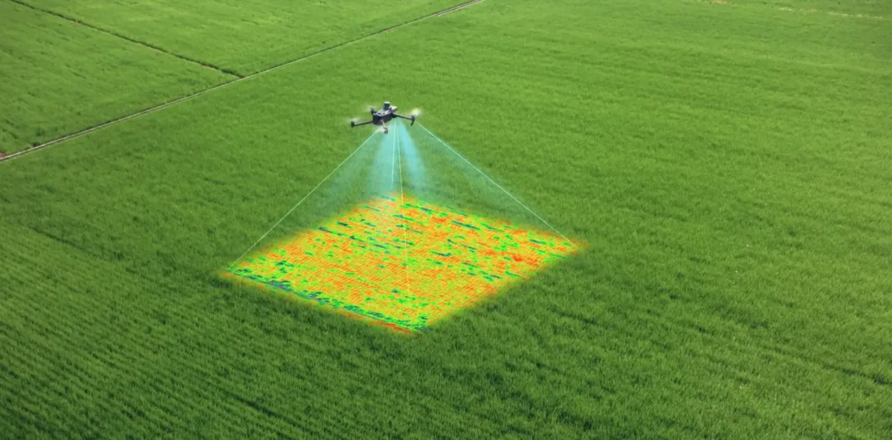
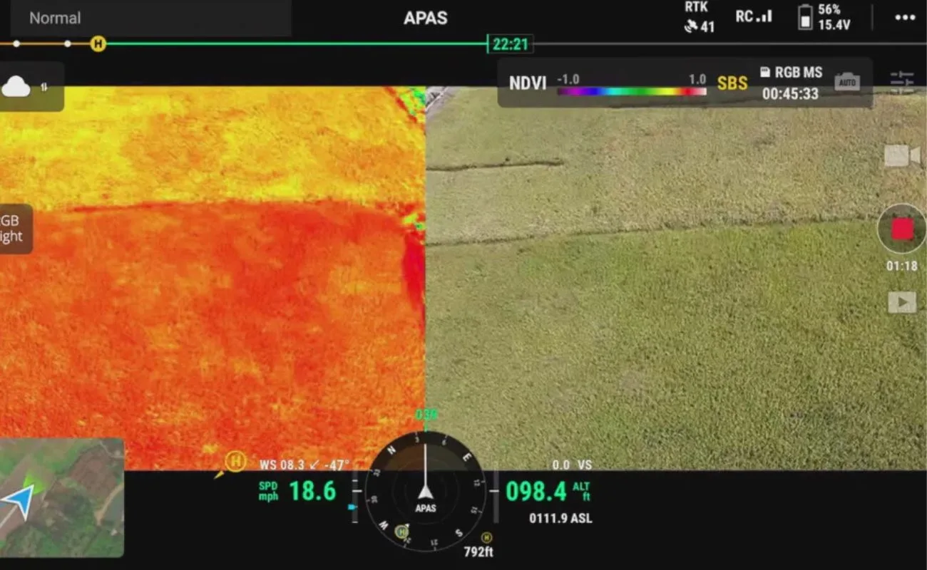
- Crop Monitoring: The multispectral camera’s Green, Red, Red Edge, and NIR bands help monitor plant health by capturing information that is invisible to the naked eye, allowing farmers to detect stress, diseases, or nutrient deficiencies early.
- Field Analysis: Data captured can be used for yield prediction, soil health assessment, and precision irrigation, leading to better decision-making and increased crop yields.
Environmental Monitoring-
- Vegetation Health: The ability to measure vegetation indices like NDVI (Normalized Difference Vegetation Index) and NDRE (Normalized Difference Red Edge) makes the Mavic 3 Multispectral a powerful tool for tracking forest health, biodiversity, and invasive species.
- Wetland & Coastal Studies: Monitoring wetlands, coastal areas, and other sensitive ecosystems for environmental changes, such as erosion, pollution, and habitat loss.
Land Surveying And Mapping-
- Topographic Mapping: The drone’s multispectral imagery is used for creating detailed topographic maps, monitoring changes over time, and assessing terrain for construction projects.
- Land Use & Urban Planning: Ideal for professionals in urban planning and land development, helping to analyze land use patterns and plan for future development.
Frequently Asked Questions: [DJI Mavic 3 Multispectral]
Answer: The DJI Mavic 3M offers a maximum flight time of 43 minutes without wind.
Answer: It is primarily used for precision agriculture, environmental monitoring, land management, and forestry mapping.
Answer: The DJI Mavic 3 Multispectral can withstand winds up to 12 m/s and operates in temperatures between -10° to 40° C (14° to 104° F).
Answer: The RTK module provides horizontal accuracy of 1 cm + 1 ppm and vertical accuracy of 1.5 cm + 1 ppm.
Answer: The Mavic 3 Thermal features a thermal camera for heat-based analysis, while the Mavic 3 Multispectral uses a multispectral camera for environmental and agricultural monitoring.
Answer: To get the best price, contact Mavdrones now for the latest offers and deals.
Answer: While designed for professional users, the DJI Mavic 3M is accessible to those with drone flying experience due to its intuitive controls and intelligent flight modes.
Conclusion: [DJI Mavic 3 Multispectral]
Now that the DJI Mavic 3 Multispectral has unlocked its secrets for you, it’s time to take this next-level technology from the skies into the real world with Mavdrones. Imagine a partner who doesn’t just understand drones – we live them. Whether it’s revolutionizing agriculture, monitoring the pulse of the environment, or mapping the future of our cities, MAVDRONES transforms aerial data into action. We’re not just a service, we’re your wings to a future of limitless potential.
Want to take flight with us? Contact MAVDRONES now, and let’s make your vision a reality.
DJI Mavic 3 Multispectral VS. DJI Mavic 3 Thermal
|
FEATURES |
DJI MAVIC 3 MULTISPECTRAL |
DJI MAVIC 3 THERMAL |
|---|---|---|
|
CAMERA TYPE |
Multispectral (Green, Red, Red Edge, NIR) |
Thermal and RGB camera combo |
|
PRIMARY USE |
Agricultural monitoring, land surveying |
Search and rescue, fire detection, inspections |
|
MAX FLIGHT TIME |
43 minutes |
45 minutes |
|
MAX SPEED |
15 m/s (Normal Mode), 21 m/s (Sport Mode) |
15 m/s (Normal Mode) |
|
CAMERA SENSOR |
5 MP multispectral camera (RGB + NIR bands) |
640x512 px thermal sensor + RGB camera |
|
VIDEO RESOLUTION |
FHD (1920×1080) |
FHD (1920×1080) |
|
RTK |
Supported with RTK module for high-precision georeferencing |
No RTK module |
|
APPLICATIONS |
Precision agriculture, environmental monitoring |
Search and rescue, industrial inspections |
While both drones offer exceptional flight capabilities and video transmission systems, the DJI Mavic Multispectral is optimized for multispectral imagery, ideal for agriculture, environmental monitoring, and land mapping. On the other hand, the Mavic 3 Thermal is tailored for situations requiring thermal imaging, such as search and rescue, firefighting, and industrial inspections.
1 review for DJI Mavic 3 Multispectral – DJI Mavic 3M Drone Agriculture Solution
Clear filters1. We ship our products all over India within 3-5 working days. This includes all 28 states and 8 Union Territories. We do not offer international shipping at this time. We apologize for any inconvenience caused.
2. We ship our products through our delivery partner Shree Tirupati Courier Services PVT. LTD . (http://www.shreetirupaticourier.net/ ) and DTDC Express LTD. (https://www.dtdc.in/index.asp). Shree Tirupati Courier has over 1500 centers in more than 21 states rest are covered by DTDC and its jargon of GPS-connected trucks.
Once we receive an order before 4 pm and we have received the payment at our bank we can process the order the very same day (if it’s a working day i.e. Monday to Saturday). If however, we receive it after 4 pm then we process the order the next working day.
3. As promised on our product page we will bear the entire charges of shipping to your location.
4. It takes around 3-5 working days to deliver the products anywhere in the country. They ship it via the above-mentioned couriers in the surface transit system. However, if you want a quicker delivery you can raise a request by getting in touch with us before placing the order(or within one hour of placing the order) through mail support@www.mavdrones.com or call us at +91 9330328517 We will arrange Air shipping in that case. You will receive the product within 1-3 working days in that case.
5. After shipping we will give you the tracking id within 2 hours of shipping. In case we ship through Shree Tirupati Courier then you can visit http://www.shreetirupaticourier.net/Frm_DocTrack.aspx?docno=%number% This page of them and put your tracking id and can get real-time updates through this tracking platform. However, if we ship through DTDC Express then you need to visit https://www.dtdc.in/tracking.asp for tracking shipping updates.
6. We have several options for sending you the tracking id i.e. we can send it in the mail, WhatsApp, or telegram.
7. If you have any problems with the delivery like:
7A. Delayed shipment: If the shipment is delayed by any chance of any more than 3-5 working days then you have the right to demand a full refund which will be processed as per our refund policy which you can see at our RETURNS< EXCHANGES AND REFUNDS POLICY or if you are willing to cooperate with us then we can enquire with the shipping company and try and find out why the delay is happening. In the latter case, we can either work with the shipping company and try and deliver the transiting item as soon as possible or we can ship a new product to your location through a different courier partner.
7B. Receiving a broken item: We strongly suggest you should make an unboxing video of the product and also keep recording till you successfully fly the drone. Therefore, if you receive a broken item we can identify it from the video and can process a RETURN, EXCHANGE, or Refund as per your wish.
8. Public Holidays and Force Majeure:
Please note that the delivery timeframe may be affected during public holidays and unforeseen circumstances beyond our control (Such as natural disasters, strikes, or transportation disruptions). We appreciate your understanding in such situations.
Related products


DJI Avata Fly More Kit – For Avata Drone
In stock







Mahima Singh –
Maverick Drones is where I bought my Mavic 3 Multispectral, and they offer an amazing service. As promised, the drone was delivered in three weeks. This drone is essentially what I bought it for: monitoring crop health. It performs admirably, with a solid 45 to 50 minute flight time. There was also better camera quality. The ability to scan and assess crop growth with complete clarity by combining an RGB camera with a multispectral camera was a feature that I truly enjoyed. Overall, the product and service were excellent. Highly recommended.