DJI Terra Pro Permanent (1 Device)
₹454,300.00
Specifications:
- Advanced Mapping Capabilities
- High-Precision Data Processing
- User-Friendly Interface
- Seamless Integration
- Efficient Data Management
And many more…
- 7 Days Return, Exchange & Refund Policy.
- Free Delivery within 3 to 5 Days.
- Assured Product Quality. We deal with only Genuine Products.
- Peace of mind Warranty. Check Our Warranty Policy.
- Contact Us for Any Assistance.
Guaranteed Safe Checkout
DJI Terra Pro Permanent (1 Device): The Ultimate Solution For Advanced Mapping And Surveying
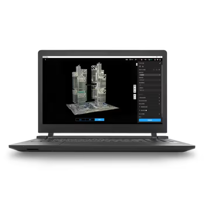
Experience unparalleled precision and efficiency with the DJI Terra Permanent (1 Device). This product is designed for professionals in mapping and surveying. Terra Pro is an advanced solution for creating highly accurate 2D and 3D models from aerial data. This software is tailored for those who demand the best results. This software is tailored for those who need a reliable tool for complex projects. Thus making this software an essential asset for industries. For industries such as construction, agriculture, and infrastructure.
VISIT THIS CATEGORY PAGE TO EXPLORE MORE SUCH PRODUCTS.
DJI Terra: Key Features
- Advanced Mapping Capabilities: DJI Terra transforms drone imagery into detailed 2D orthophotos and 3D models. It supports various mapping missions, including area surveys, corridor mapping, and more. Thus ensuring that you can handle diverse project requirements with ease.
- High-Precision Data Processing: With Terra Pro, achieve exceptional accuracy in your mapping projects. This software processes data from your DJI drones to produce HD maps and models. Thus allowing for precise measurements and in-depth analysis.
- User-Friendly Interface: DJI Terra features an intuitive interface that simplifies the mapping process. You might be a seasoned professional or new to drone mapping. Choose and buy this software to ensure a smooth and efficient workflow.
- Seamless Integration: The Terra Pro software integrates seamlessly with various DJI drones. Thus ensuring that you can fully utilize your existing equipment. This compatibility allows for a streamlined workflow from data capture to final analysis.
- Efficient Data Management: DJI Terra offers robust data management features. Thus enabling you to organize and access your mapping projects with ease. You can manage large datasets and ensure that all your data is readily available.
DJI Terra: Pricing And Availability
The DJI Terra Pro Permanent (1 Device) is available at a competitive DJI Terra Pro Price. The investment in this software is a valuable one. Given its advanced features and the efficiency it brings to your mapping projects. For detailed information on DJI Terra Software Price, please visit the DJI website. Terra Pro offers exceptional value. Along with pricing that reflects the advanced capabilities of this software. It’s a cost-effective solution for professionals who require precise mapping tools. The fair DJI Terra Cost makes this product worth buying.
DJI Terra: Download And Installation
DJI Terra is available for download directly from the DJI website. The DJI Terra Download process is straightforward, and installation is quick. All this allows you to start your mapping projects without delay. Comprehensive support and resources are available to assist with installation and setup. Thus enabling a smooth start to your usage of the software. For the DJI Terra Download process, follow the process that is mentioned above.
Comparing DJI Terra Pro To Other Software
When evaluating DJI Terra against other mapping software options, it stands out for its specialized features and tailored capabilities. Other software might offer basic mapping functions. However, Terra Pro excels in providing high-precision results and advanced analytical tools. Thus making it a superior choice for professional applications. This software’s cost reflects its top performance and the value it brings to projects.
DJI Terra: Compatibility With DJI Matrice 350 RTK And Zenmuse L2
DJI Terra is compatible with the DJI MATRICE 350 RTK and ZENMUSE L2. Thus delivering exceptional performance for advanced aerial mapping and surveying. The Matrice 350 RTK provides high-precision positioning and stability. Which, when paired with Terra Pro, enhances data accuracy and mapping quality. Zenmuse L2, with its advanced LiDAR capabilities, integrates seamlessly with DJI Terra Pro.
All this to generate highly detailed 3D models and topographic maps. This synergy ensures that users can capture and process intricate details with unparalleled precision. Thus making this product an ideal solution for complex surveying tasks and HD mapping projects. Whether for infrastructure inspections, environmental studies, or construction planning. The combination of Terra Pro, the Matrice 350 RTK, and the Zenmuse L2 set a new standard in aerial data acquisition and analysis.
DJI Terra: Purchase This Product Today
The DJI Terra Permanent (1 Device) is a premier choice for professionals. For professionals seeking advanced mapping and surveying solutions. This product includes powerful features, a user-friendly interface, and seamless integration with DJI drones. This Software DJI Terra offers everything needed for high-precision data processing. This Software DJI Terra offers everything needed for detailed mapping. Invest in Terra Pro to enhance your mapping capabilities. Achieve exceptional results in your projects.
1. We ship our products all over India within 3-5 working days. This includes all 28 states and 8 Union Territories. We do not offer international shipping at this time. We apologize for any inconvenience caused.
2. We ship our products through our delivery partner Shree Tirupati Courier Services PVT. LTD . (http://www.shreetirupaticourier.net/ ) and DTDC Express LTD. (https://www.dtdc.in/index.asp). Shree Tirupati Courier has over 1500 centers in more than 21 states rest are covered by DTDC and its jargon of GPS-connected trucks.
Once we receive an order before 4 pm and we have received the payment at our bank we can process the order the very same day (if it’s a working day i.e. Monday to Saturday). If however, we receive it after 4 pm then we process the order the next working day.
3. As promised on our product page we will bear the entire charges of shipping to your location.
4. It takes around 3-5 working days to deliver the products anywhere in the country. They ship it via the above-mentioned couriers in the surface transit system. However, if you want a quicker delivery you can raise a request by getting in touch with us before placing the order(or within one hour of placing the order) through mail support@mavdrones.com or call us at +91 9330328517 We will arrange Air shipping in that case. You will receive the product within 1-3 working days in that case.
5. After shipping we will give you the tracking id within 2 hours of shipping. In case we ship through Shree Tirupati Courier then you can visit http://www.shreetirupaticourier.net/Frm_DocTrack.aspx?docno=%number% This page of them and put your tracking id and can get real-time updates through this tracking platform. However, if we ship through DTDC Express then you need to visit https://www.dtdc.in/tracking.asp for tracking shipping updates.
6. We have several options for sending you the tracking id i.e. we can send it in the mail, WhatsApp, or telegram.
7. If you have any problems with the delivery like:
7A. Delayed shipment: If the shipment is delayed by any chance of any more than 3-5 working days then you have the right to demand a full refund which will be processed as per our refund policy which you can see at our RETURNS< EXCHANGES AND REFUNDS POLICY or if you are willing to cooperate with us then we can enquire with the shipping company and try and find out why the delay is happening. In the latter case, we can either work with the shipping company and try and deliver the transiting item as soon as possible or we can ship a new product to your location through a different courier partner.
7B. Receiving a broken item: We strongly suggest you should make an unboxing video of the product and also keep recording till you successfully fly the drone. Therefore, if you receive a broken item we can identify it from the video and can process a RETURN, EXCHANGE, or Refund as per your wish.
8. Public Holidays and Force Majeure:
Please note that the delivery timeframe may be affected during public holidays and unforeseen circumstances beyond our control (Such as natural disasters, strikes, or transportation disruptions). We appreciate your understanding in such situations.





Reviews
Clear filtersThere are no reviews yet.