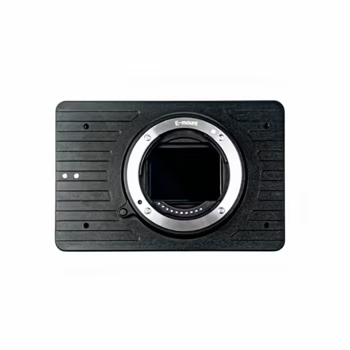
ADTi 61MP 61S Surveyor Drone Mapping Cameras
Specifications:
Sensor Type: CMOS
Sensor Manufacturer: Sony
Effective Megapixels: 61
Sensor Format: Full Frame
Sensor Size: 849.6 mm² (35.7 x 23.8 mm)
Pixel Pitch: 3.76 microns
And many more…
- 7 Days Return, Exchange & Refund Policy.
- Free Delivery within 3 to 5 Days.
- Assured Product Quality. We deal with only Genuine Products.
- Peace of mind Warranty. Check Our Warranty Policy.
- Contact Us for Any Assistance.
Guaranteed Safe Checkout
ADTi 61MP 61S Surveyor Drone Mapping Cameras
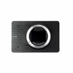
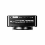
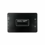
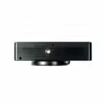
Introducing the ADTi 61MP 61S Surveyor Drone Mapping Cameras—a high-resolution imaging solution designed for professional aerial mapping and surveying. This advanced 61MP Drone Camera combines cutting-edge technology with robust performance, making it an essential tool for surveyors, cartographers, and mapping professionals.
THESE ADTI 61MP 61S SURVEYOR DRONE MAPPING CAMERAS ARE RELATED ADTI 26MP 26S V2 SURVEYOR DRONE MAPPING CAMERAS. VISIT THIS CATEGORY PAGE TO EXPLORE MORE SUCH PRODUCTS.
ADTi 61MP 61S Surveyor Drone Mapping Cameras: Key Features
- 61 Megapixel Full-Frame Sony CMOS Sensor: Capture every detail with stunning clarity and precision, thanks to the high-resolution 61MP full-frame Sony CMOS sensor.
- Compatible with E-Mount Full-Frame Lenses: Flexibility to use any E-mount full-frame lenses, including ADTi lightweight FF lenses such as 18MM FF, 50MM FF, and 56MM FF.
- Bionz X Image Processor: Enhance image quality and processing speed with the powerful Bionz X image processor, ensuring top dynamic range and very low noise.
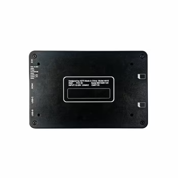
- Built-in Multi-Interface Hot Shoe Output for PPK: Integrate seamlessly with Post Processed Kinematic (PPK) systems for precise geospatial data collection.
- High-Speed Continuous Shooting: Capture fast-moving subjects with 10 frames per second. This Aerial Mapping Camera ensures you never miss a moment.
- 4K Video Recording: Record stunning 4K video, making it ideal for both still and motion imagery in your mapping projects.
- Lightweight Design: Weighing only 276g, this camera is easy to integrate into various drone platforms without adding significant weight.
ADTi 61MP 61S Surveyor Drone Mapping Cameras: Superior Imaging Technology
The ADTi 61MP 61S Surveyor Drone Mapping Cameras are equipped with the latest imaging technology. This ADTi Surveyor Camera features a full-frame Sony CMOS sensor and the Bionz X image processor. This combination ensures exceptional image quality, dynamic range, and minimal noise, making it perfect for capturing detailed and accurate aerial images.
ADTi 61MP 61S Surveyor Drone Mapping Cameras: Detailed Specifications
Image Sensor:
- Sensor Type: CMOS
- Sensor Manufacturer: Sony
- Effective Megapixels: 61
- Sensor Format: Full Frame
- Sensor Size: 849.6 mm² (35.7 x 23.8 mm)
- Pixel Pitch: 3.76 microns
- Aspect Ratio: 3:2
- Color Filter Type: RGBG
- Color Depth: 26 bits
- Maximum Effective ISO: 3,344
Image Capture:
- Image Resolution:
- 9504 x 6336 (60.2 MP, 3:2)
- 6240 x 4160 (26.0 MP, 3:2)
- 4752 x 3168 (15.1 MP, 3:2)
- 8448 x 6336 (53.5 MP, 4:3)
- 5552 x 4160 (23.1 MP, 4:3)
- 4224 x 3168 (13.4 MP, 4:3)
- 9504 x 5344 (50.8 MP, 16:9)
- 6240 x 3512 (21.9 MP, 16:9)
- 4752 x 2672 (12.7 MP, 16:9)
- 6336 x 6336 (40.1 MP, 1:1)
- 4160 x 4160 (17.3 MP, 1:1)
- 3168 x 3168 (10.0 MP, 1:1)
- Image File Format: JPEG, RAW (14-bit ARW 2.3), RAW+JPEG
- Continuous-mode frames/second: 10.0
Video Capture:
- Video Resolution:
- 3840x2160 (30p/25p/24p)
- 1920x1080 (120p/100p/60p/60i/50p/50i/30p/25p/24p)
- XAVC S / AVCHD 2.0 / MP4 is the video file format; LPCM / Dolby Digital (AC-3) / MPEG-4 AAC-LC, stereo
- HD Video Out: Yes
- HD Video Connection: HDMI
Lens & Optics:
- Lens Mount: Sony E
- Auto Focus: Yes
- Manual Focus: Yes
- Shutter Type: Mechanical shutter
- Shutter Speed: 1/8000-30 sec
Camera:
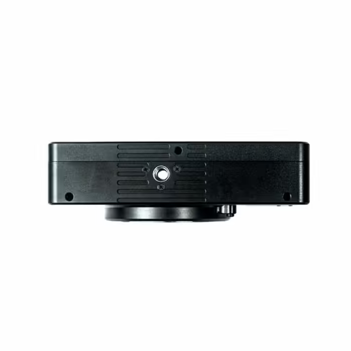
- Camera Size: 12 x 8 x 4.2 cm
- Camera Weight (body): 276 g
- Package Size: 50 x 50 x 25 cm
- Package Weight: 800 g
- Power: 12-28V DC Lipo or Li-ion
- Operating Temperature: -10 to 40°C
ADTi 61MP 61S Surveyor Drone Mapping Cameras: Versatile Compatibility
The ADTi 61MP 61S is compatible with the Airpixel R3, as well as Gremsy Pixy S 3-axis camera gimbal and ADTI 2-Axis nadir fixed wing gimbal. This versatility in this High-Resolution Mapping Camera allows you to customize your setup to meet the specific needs of your surveying and mapping projects.
Enhance your aerial survey capabilities with the ADTi 61MP 61S Surveyor Drone Mapping Cameras. This Surveyor Drone Camera 61MP’s advanced features, robust design, and superior imaging technology ensure you achieve unparalleled accuracy and efficiency in your mapping projects. Order yours today and take your professional surveying to the next level.
ADTi 61MP 61S Surveyor Drone Mapping Cameras: Unmatched Image Quality
The ADTi 61MP 61S Surveyor Drone Mapping Cameras set a new standard in aerial imaging with their unparalleled image quality. The 61MP full-frame Sony CMOS sensor ensures every detail is captured with exceptional clarity and precision, making this Professional Mapping Drone Camera ideal for detailed mapping and surveying tasks. With the powerful Bionz X image processor, you can expect top dynamic range and very low noise, even in challenging lighting conditions.
ADTi 61MP 61S Surveyor Drone Mapping Cameras: Versatile Lens Compatibility
Flexibility is a key feature of the ADTi 61MP 61S Surveyor Drone Mapping Cameras. This camera is compatible with a wide range of E-mount full-frame lenses, including ADTi's lightweight FF lenses such as the 18MM FF, 50MM FF, and 56MM FF. This versatility in the 61MP Surveyor Drone camera allows you to choose the best lens for your specific mapping needs, whether you're capturing wide landscapes or focusing on detailed close-ups.
ADTi 61MP 61S Surveyor Drone Mapping Cameras: Superior Video Capabilities
In addition to its impressive still image performance, the ADTi 61MP 61S Surveyor Drone Mapping Cameras excels in video capture. This ADTi 61MP Drone Camera supports 4K video recording, ensuring that your aerial videos are captured with stunning detail and clarity. Whether you're documenting survey sites or creating professional-quality videos, this camera delivers exceptional video quality that meets the highest standards.
ADTi 61MP 61S Surveyor Drone Mapping Cameras: Lightweight And Durable Design
Weighing only 276g, the ADTi 61MP 61S Surveyor Drone Mapping Cameras are designed for easy integration into various drone platforms without adding significant weight. Its robust ABS plastic housing ensures durability, making this Advanced Surveyor Drone Camera suitable for use in a range of environmental conditions. The compact design, combined with high performance, makes this camera a perfect choice for professional surveyors and mappers who need reliable and portable equipment.
ADTi 61MP 61S Surveyor Drone Mapping Cameras: Seamless Integration With Surveying Equipment
The ADTi 61MP 61S Surveyor Drone Mapping Cameras are designed to seamlessly integrate with advanced surveying equipment. This Drone Camera For Surveying is compatible with the Airpixel R3 and can be used with the Gremsy Pixy S 3-axis camera gimbal or the ADTI 2-Axis nadir fixed wing gimbal. This compatibility ensures that you can tailor your setup to your specific project requirements, enhancing the efficiency and accuracy of your aerial surveys.
1. We ship our products all over India within 3-5 working days. This includes all 28 states and 8 Union Territories. We do not offer international shipping at this time. We apologize for any inconvenience caused.
2. We ship our products through our delivery partner Shree Tirupati Courier Services PVT. LTD . (http://www.shreetirupaticourier.net/ ) and DTDC Express LTD. (https://www.dtdc.in/index.asp). Shree Tirupati Courier has over 1500 centers in more than 21 states rest are covered by DTDC and its jargon of GPS-connected trucks.
Once we receive an order before 4 pm and we have received the payment at our bank we can process the order the very same day (if it’s a working day i.e. Monday to Saturday). If however, we receive it after 4 pm then we process the order the next working day.
3. As promised on our product page we will bear the entire charges of shipping to your location.
4. It takes around 3-5 working days to deliver the products anywhere in the country. They ship it via the above-mentioned couriers in the surface transit system. However, if you want a quicker delivery you can raise a request by getting in touch with us before placing the order(or within one hour of placing the order) through mail support@mavdrones.com or call us at +91 9330328517 We will arrange Air shipping in that case. You will receive the product within 1-3 working days in that case.
5. After shipping we will give you the tracking id within 2 hours of shipping. In case we ship through Shree Tirupati Courier then you can visit http://www.shreetirupaticourier.net/Frm_DocTrack.aspx?docno=%number% This page of them and put your tracking id and can get real-time updates through this tracking platform. However, if we ship through DTDC Express then you need to visit https://www.dtdc.in/tracking.asp for tracking shipping updates.
6. We have several options for sending you the tracking id i.e. we can send it in the mail, WhatsApp, or telegram.
7. If you have any problems with the delivery like:
7A. Delayed shipment: If the shipment is delayed by any chance of any more than 3-5 working days then you have the right to demand a full refund which will be processed as per our refund policy which you can see at our RETURNS< EXCHANGES AND REFUNDS POLICY or if you are willing to cooperate with us then we can enquire with the shipping company and try and find out why the delay is happening. In the latter case, we can either work with the shipping company and try and deliver the transiting item as soon as possible or we can ship a new product to your location through a different courier partner.
7B. Receiving a broken item: We strongly suggest you should make an unboxing video of the product and also keep recording till you successfully fly the drone. Therefore, if you receive a broken item we can identify it from the video and can process a RETURN, EXCHANGE, or Refund as per your wish.
8. Public Holidays and Force Majeure:
Please note that the delivery timeframe may be affected during public holidays and unforeseen circumstances beyond our control (Such as natural disasters, strikes, or transportation disruptions). We appreciate your understanding in such situations.













Reviews
Clear filtersThere are no reviews yet.