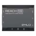
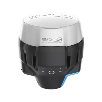
Reach M2
₹63,563.00
Specifications:
- Advanced Technology For Superior Accuracy
- Tailored For UAV And Surveying Applications
- Post-Processing For Enhanced Accuracy
- User-Friendly Interface And Seamless Integration
- A Cost-Effective Solution
And many more…
- 7 Days Return, Exchange & Refund Policy.
- Free Delivery within 3 to 5 Days.
- Assured Product Quality. We deals with only Genuine Products.
- Peace of mind Warranty. Check Our Warranty Policy.
- Contact Us for Any Assistance.
Guaranteed Safe Checkout
Emlid Reach M2: Precision And Versatility In GNSS Technology
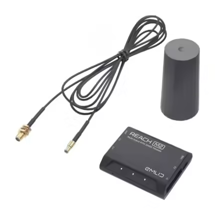
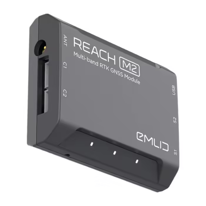
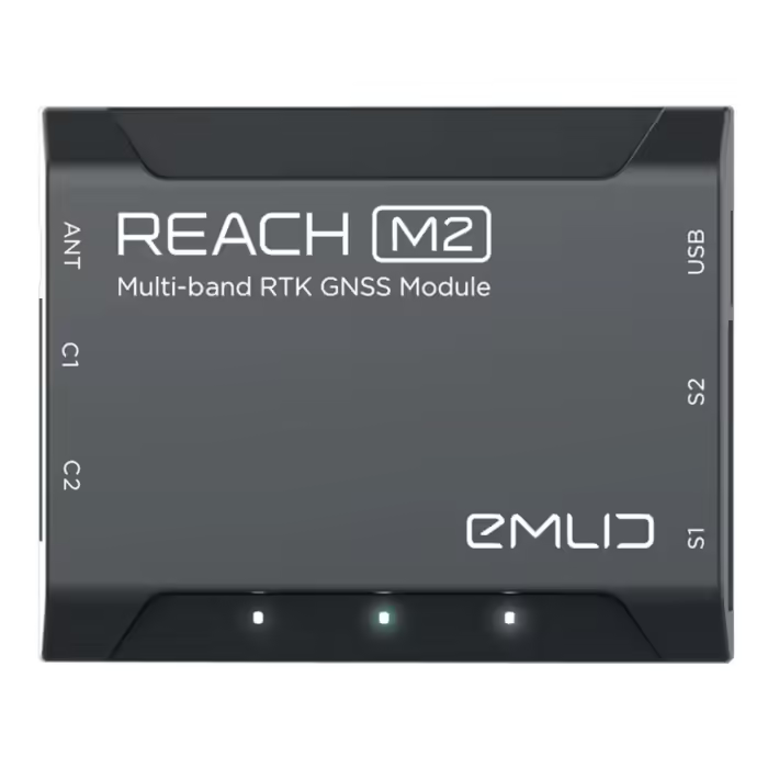
The Reach M2 is a cutting-edge GNSS module. This product offers unparalleled accuracy and versatility for various applications. The M2 Reach delivers precision for aerial mapping, land surveying, or precision agriculture. Emlid, a leader in GNSS technology, develops this product. The Emlid M2 provides high-performance positioning with ease of use. All this makes this product essential for anyone requiring accurate geospatial data.
VISIT THIS CATEGORY PAGE TO EXPLORE MORE SUCH PRODUCTS.
Reach M2: Advanced Technology For Superior Accuracy
At the heart of the Reach M2 is its advanced multi-band GNSS technology. It can track GPS, GLONASS, Galileo, and BeiDou satellites across several frequency bands. The M2 Reach ensures fast and precise positioning even in challenging environments. Whether you're working in dense urban areas, under heavy foliage, or in other difficult conditions, the M2 Reach consistently delivers centimeter-level accuracy. Making this Reach M2 RTK ideal for high-stakes applications where precision is critical.
Reach M2: Tailored For UAV And Surveying Applications
The Emlid M2 is particularly well-suited for integration with UAVs. For providing accurate georeferencing for aerial imagery. Its lightweight and compact design makes it easy to mount on various drones. Its high accuracy ensures that your aerial data is precise and reliable. For land surveyors, the Reach M2 RTK functionality offers real-time kinematic positioning. This allows you to achieve survey-grade accuracy in the field. Whether you're mapping large areas, establishing ground control points, or conducting detailed surveys, the M2 Reach is a versatile and powerful tool that meets the demands of modern surveying.
Emlid Reach M2 PPK: Post-Processing For Enhanced Accuracy
In addition to RTK capabilities, the Reach M2 also supports PPK positioning. Emlid M2 PPK collects raw GNSS data during fieldwork. Then, processes later to achieve even higher accuracy. This feature is valuable in areas where real-time corrections are unavailable. Or areas where maximum precision is required. This product has the flexibility of switching between RTK and PPK modes. This makes the M2 Reach best for various geospatial tasks. This tool achieves the best possible results in any scenario.
Reach M2: User-Friendly Interface And Seamless Integration
The Reach M2 is designed with ease of use in mind. Its intuitive interface allows users to set up and operate the device with minimal training. Thus reducing the time spent on configuration and troubleshooting. The Emlid M2 is compatible with various devices and software. Thus making it easy to integrate into your existing workflows. Whether you're using it with a UAV for aerial mapping or as part of a land surveying kit, the M2 Reach fits seamlessly into your operations, enhancing efficiency and productivity.
Reach M2: A Cost-Effective Solution
Despite its advanced capabilities, the Reach M2 is a cost-effective solution. This product offers excellent value for professionals in need of high-precision GNSS data. Compared to other GNSS modules, the M2 Reach delivers great performance at a competitive price. Thus making it accessible to a wide range of users. You might be an independent surveyor, a drone operator, or part of a larger geospatial team. Choose and buy this Emlid M2, as it provides the accuracy you need without breaking the bank.
Reach M2: Purchase This Product Now: The Ultimate GNSS Solution For Precision And Reliability
The Reach M2 by Emlid is more than just a GNSS module. It is a comprehensive solution for accurate and reliable geospatial data. It includes advanced multi-band GNSS technology, RTK and PPK capabilities, and user-friendly design. The M2 Reach is the top choice for professionals. For professionals in aerial mapping, land surveying, and precision agriculture. You might be in the field collecting data or processing it back in the office. Choose and buy M2 Reach as it delivers the precision you need to succeed in your projects. Investing in Emlid M2 PPK means equipping yourself with the best technology available. To complete your task with the utmost precision and effectiveness.
1. We ship our products all over India within 3-5 working days. This includes all 28 states and 8 Union Territories. We do not offer international shipping at this time. We apologize for any inconvenience caused.
2. We ship our products through our delivery partner Shree Tirupati Courier Services PVT. LTD . (http://www.shreetirupaticourier.net/ ) and DTDC Express LTD. (https://www.dtdc.in/index.asp). Shree Tirupati Courier has over 1500 centers in more than 21 states rest are covered by DTDC and its jargon of GPS-connected trucks.
Once we receive an order before 4 pm and we have received the payment at our bank we can process the order the very same day (if it’s a working day i.e. Monday to Saturday). If however, we receive it after 4 pm then we process the order the next working day.
3. As promised on our product page we will bear the entire charges of shipping to your location.
4. It takes around 3-5 working days to deliver the products anywhere in the country. They ship it via the above-mentioned couriers in the surface transit system. However, if you want a quicker delivery you can raise a request by getting in touch with us before placing the order(or within one hour of placing the order) through mail support@www.mavdrones.com or call us at +91 9330328517 We will arrange Air shipping in that case. You will receive the product within 1-3 working days in that case.
5. After shipping we will give you the tracking id within 2 hours of shipping. In case we ship through Shree Tirupati Courier then you can visit http://www.shreetirupaticourier.net/Frm_DocTrack.aspx?docno=%number% This page of them and put your tracking id and can get real-time updates through this tracking platform. However, if we ship through DTDC Express then you need to visit https://www.dtdc.in/tracking.asp for tracking shipping updates.
6. We have several options for sending you the tracking id i.e. we can send it in the mail, WhatsApp, or telegram.
7. If you have any problems with the delivery like:
7A. Delayed shipment: If the shipment is delayed by any chance of any more than 3-5 working days then you have the right to demand a full refund which will be processed as per our refund policy which you can see at our RETURNS< EXCHANGES AND REFUNDS POLICY or if you are willing to cooperate with us then we can enquire with the shipping company and try and find out why the delay is happening. In the latter case, we can either work with the shipping company and try and deliver the transiting item as soon as possible or we can ship a new product to your location through a different courier partner.
7B. Receiving a broken item: We strongly suggest you should make an unboxing video of the product and also keep recording till you successfully fly the drone. Therefore, if you receive a broken item we can identify it from the video and can process a RETURN, EXCHANGE, or Refund as per your wish.
8. Public Holidays and Force Majeure:
Please note that the delivery timeframe may be affected during public holidays and unforeseen circumstances beyond our control (Such as natural disasters, strikes, or transportation disruptions). We appreciate your understanding in such situations.







Reviews
Clear filtersThere are no reviews yet.