Pix4DMapper
₹618,467.00
Specifications:
- Advanced Photogrammetry
- Comprehensive Mapping Drone Software
- Flexible Data Inputs
- User-Friendly Interface
- Customizable Processing Options
And many more…
- 7 Days Return, Exchange & Refund Policy.
- Free Delivery within 3 to 5 Days.
- Assured Product Quality. We deal with only Genuine Products.
- Peace of mind Warranty. Check Our Warranty Policy.
- Contact Us for Any Assistance.
Guaranteed Safe Checkout
Pix4DMapper: Advanced Drone Mapping Software For Precise Photogrammetry
Introducing Pix4DMapper, the leading Drone Mapping Software designed to transform aerial images into precise, actionable data. Including the industry standard for photogrammetry, this mapper software offers unparalleled accuracy, flexibility, and ease of use for professionals across various fields, including surveying, construction, agriculture, and more. Whether you're conducting site surveys, creating topographic maps, or generating 3D models, this mapper software provides everything you need for comprehensive and reliable aerial mapping.
THIS PIX4DMAPPER IS COMPATIBLE WITH DJI MAVIC 3 ENTERPRISE. CHECK OUT THE RELATED SOFTWARE. VISIT THIS CATEGORY PAGE TO EXPLORE MORE SUCH PRODUCTS.
Pix4DMapper: Key Features
- Advanced Photogrammetry: Pix4DMapper uses advanced photogrammetry techniques to convert raw aerial images into highly accurate 2D maps and 3D models. This ensures precise measurements and detailed visualizations.
- Comprehensive Mapping Drone Software: As a leading Drone Mapping Software, it supports various mapping needs, from simple 2D orthomosaics to complex 3D point clouds, meshes, and textured models.
- Flexible Data Inputs: Pix4DMapper is compatible with a wide range of drones and cameras, making it a versatile tool for different projects and industries.
- User-Friendly Interface: Designed with both beginners and experts in mind, this mapper software features an intuitive interface that simplifies the mapping process. Easy-to-follow workflows guide users from data capture to final output.
- Customizable Processing Options: Tailor the processing settings to meet specific project requirements. Pix4DMapper offers detailed control over the photogrammetry process, ensuring optimal results for each unique application.
Pix4DMapper: Answering Your Questions
What Is PIX4Dmapper Used For?
Pix4DMapper is used for converting aerial imagery into detailed maps and 3D models. It is widely used in industries such as:
- Surveying: For creating accurate topographic maps and digital elevation models (DEMs).
- Construction: For site surveys, progress tracking, and project management.
- Agriculture: For crop monitoring, health assessment, and precision farming.
- Mining: For volume measurement, site planning, and resource management.
- Inspection: For infrastructure assessment and maintenance planning.
What Is The Difference Between PIX4DMapper And PIX4DSurvey?
While both Pix4DMapper and PIX4DSurvey are designed for aerial mapping, they serve different purposes. Pix4DMapper focuses on creating detailed 2D maps and 3D models from aerial images, making it ideal for a wide range of applications. On the other hand, PIX4DSurvey is tailored for surveyors and GIS professionals, offering everything to extract and work with topographic and cadastral features directly from the point cloud data generated by this mapper.
What Is The Difference Between PIX4DMapper And Pix4D Fields?
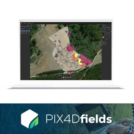
PIX4DMapper and Pix4D Fields serve different industries with specific needs. PIX4DMapper is a versatile tool used across various sectors for general mapping and modeling purposes. Pix4D Fields, however, is specifically designed for agricultural applications. This Pix4d Mapper Pro provides tools for crop monitoring, health assessment, and precision farming, allowing farmers to make data-driven decisions to optimize yield and productivity.
Is Pix4D Better Than DroneDeploy?
The choice between Pix4D and DroneDeploy depends on specific project requirements and user preferences. Pix4DMapper is renowned for its advanced Pix4d Mapper Photogrammetry capabilities, detailed customization options, and robust processing power. It is ideal for users who need high precision and control over their mapping projects. DroneDeploy, on the other hand, is known for its user-friendly interface and ease of use, making it a popular choice for beginners and those seeking quick, straightforward mapping solutions. Try using the Pix4d Mapping Software instead.
Why Choose Pix4DMapper?
Pix4DMapper stands out as the premier choice for professionals seeking high-quality Drone Mapping Software. With its advanced photogrammetry, comprehensive features, and user-friendly design, this mapper software provides the precision and reliability needed for various Pix4d Drone Mapping applications. Whether you are a surveyor, farmer, construction manager, or researcher, Pix4DMapper offers everything you need to succeed.
Pix4DMapper Price
Pix4DMapper pricing varies depending on the specific needs and scale of your projects. Various subscription plans are available to cater to different budgets and usage levels, ensuring that you can find a plan that suits your requirements. For detailed pricing information and to explore the best option for your needs, please visit the Pix4D website or contact our sales team. The fair Pix4dmapper Cost makes this product worth buying.
Pix4DMapper: Enhanced Productivity And Collaboration
One of the significant advantages of Pix4DMapper is its ability to enhance productivity and collaboration. The Pix4d Mapper Software's cloud processing capabilities allow for seamless data sharing and collaboration among team members, ensuring that everyone has access to the latest maps and models. This feature is particularly valuable for large projects that require coordinated efforts from multiple stakeholders.
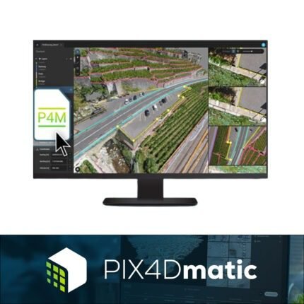
Comparing PIX4DMapper Vs PIX4Dmatic
When comparing PIX4DMapper vs. PIX4Dmatic, it's essential to understand their respective strengths. PIX4DMapper excels in general mapping applications, offering extensive customization and high precision. PIX4Dmatic, on the other hand, is designed for large-scale mapping projects, providing faster processing times and handling more significant amounts of data. Both tools are valuable, but PIX4Dmatic may be more suitable for projects requiring rapid, large-area data processing.
Pix4DMapper: Compatibility With Mavic 3 Enterprise
Pix4DMapper is highly compatible with the Mavic 3 Enterprise, making it an excellent choice for professionals who require detailed and precise mapping solutions. The Mavic 3 Enterprise captures high-quality images and geospatial data that this mapper processes with ease, transforming raw data into accurate 2D maps and 3D models. This compatibility ensures that you can utilize the advanced capabilities of both the Mavic 3 Enterprise and Pix4DMapper to achieve superior results in applications such as surveying, construction, inspection, and more. Together, they provide a robust solution for all your aerial mapping needs.
Pix4DMapper: Buy Now
Pix4DMapper is the ultimate solution for professionals needing accurate, reliable, and versatile Drone Mapping Software. Its advanced photogrammetry capabilities, user-friendly interface, and flexible processing options make it the go-to choice for a wide range of applications. Explore the power of this mapper software today and elevate your mapping projects to new heights.
1. We ship our products all over India within 3-5 working days. This includes all 28 states and 8 Union Territories. We do not offer international shipping at this time. We apologize for any inconvenience caused.
2. We ship our products through our delivery partner Shree Tirupati Courier Services PVT. LTD . (http://www.shreetirupaticourier.net/ ) and DTDC Express LTD. (https://www.dtdc.in/index.asp). Shree Tirupati Courier has over 1500 centers in more than 21 states rest are covered by DTDC and its jargon of GPS-connected trucks.
Once we receive an order before 4 pm and we have received the payment at our bank we can process the order the very same day (if it’s a working day i.e. Monday to Saturday). If however, we receive it after 4 pm then we process the order the next working day.
3. As promised on our product page we will bear the entire charges of shipping to your location.
4. It takes around 3-5 working days to deliver the products anywhere in the country. They ship it via the above-mentioned couriers in the surface transit system. However, if you want a quicker delivery you can raise a request by getting in touch with us before placing the order(or within one hour of placing the order) through mail support@mavdrones.com or call us at +91 9330328517 We will arrange Air shipping in that case. You will receive the product within 1-3 working days in that case.
5. After shipping we will give you the tracking id within 2 hours of shipping. In case we ship through Shree Tirupati Courier then you can visit http://www.shreetirupaticourier.net/Frm_DocTrack.aspx?docno=%number% This page of them and put your tracking id and can get real-time updates through this tracking platform. However, if we ship through DTDC Express then you need to visit https://www.dtdc.in/tracking.asp for tracking shipping updates.
6. We have several options for sending you the tracking id i.e. we can send it in the mail, WhatsApp, or telegram.
7. If you have any problems with the delivery like:
7A. Delayed shipment: If the shipment is delayed by any chance of any more than 3-5 working days then you have the right to demand a full refund which will be processed as per our refund policy which you can see at our RETURNS< EXCHANGES AND REFUNDS POLICY or if you are willing to cooperate with us then we can enquire with the shipping company and try and find out why the delay is happening. In the latter case, we can either work with the shipping company and try and deliver the transiting item as soon as possible or we can ship a new product to your location through a different courier partner.
7B. Receiving a broken item: We strongly suggest you should make an unboxing video of the product and also keep recording till you successfully fly the drone. Therefore, if you receive a broken item we can identify it from the video and can process a RETURN, EXCHANGE, or Refund as per your wish.
8. Public Holidays and Force Majeure:
Please note that the delivery timeframe may be affected during public holidays and unforeseen circumstances beyond our control (Such as natural disasters, strikes, or transportation disruptions). We appreciate your understanding in such situations.






Reviews
Clear filtersThere are no reviews yet.