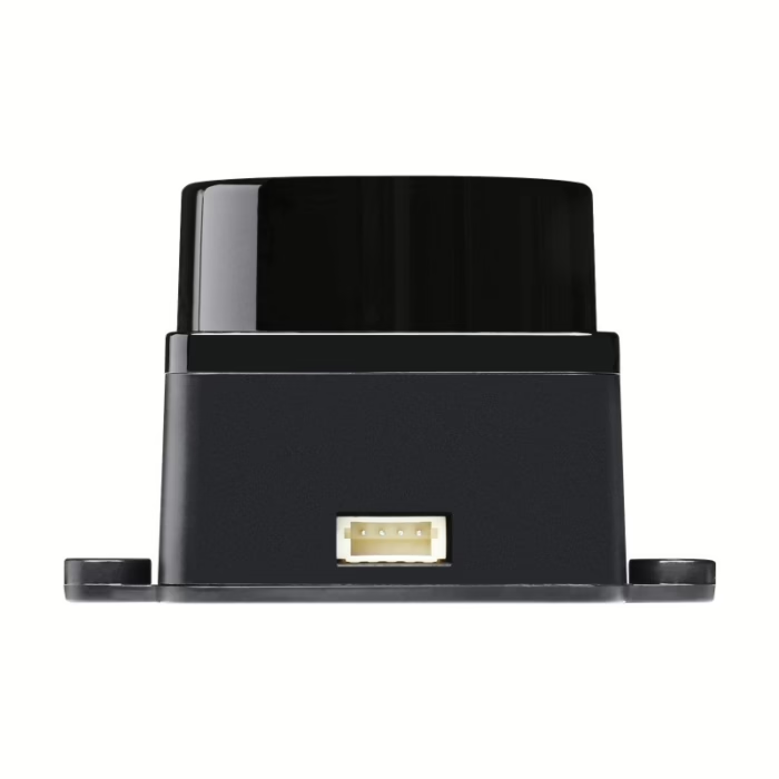
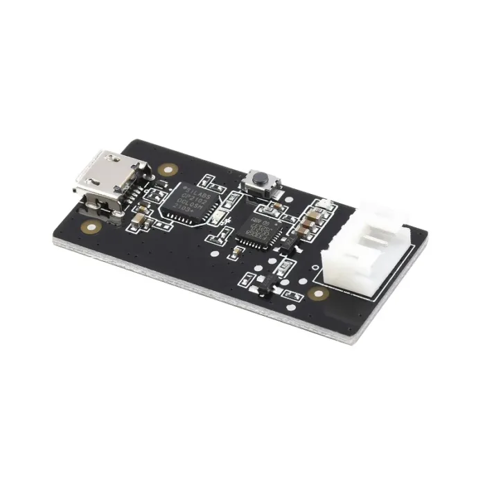
LDROBOT D500 LiDAR kit
- Model Type: LiDAR Kit
- Ranging Distance: 0.03 ~ 12m
- Scanning Frequency (Hz): 10
- Working Current (mA): 290
- Power Supply (V): 5V
- Weight (g): 50g
- Operating Temperature (°C): -10°C to 45°C
- Sampling Frequency (Hz): 5000
- Scanning Range (°): 360°
- Shipping Weight: 0.045 kg
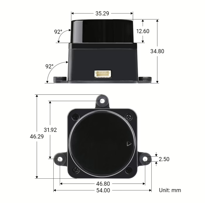
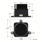
- Shipping Dimensions: 5.4 × 4.629 × 3.5 cm
- 7 Days Return, Exchange & Refund Policy.
- Free Delivery within 3 to 5 Days.
- Assured Product Quality. We deals with only Genuine Products.
- Peace of mind Warranty. Check Our Warranty Policy.
- Contact Us for Any Assistance.
Guaranteed Safe Checkout
In the world of precision mapping and measurement, LiDAR (Light Detection and Ranging) technology is a game-changer. The LDROBOT D500 LiDAR Kit is a high-performance, compact solution designed to bring cutting-edge LiDAR technology to a wide range of industries. Whether you're working in agriculture, construction, surveying, or robotics, the D500 LiDAR Kit provides the accuracy and efficiency needed to enhance your projects. In this blog post, we’ll explore the features, technical specifications, and real-world applications of this advanced LiDAR system.
Key Features And Specifications Of Ldrobot D500 LiDAR Kit
The Ldrobot D500 LiDAR Kit is packed with features designed to meet the demanding needs of modern industries. Below is a breakdown of the technical specifications that make it stand out in the field of LiDAR technology:
- Model Type: LiDAR Kit
- Ranging Distance: 0.03 ~ 12m
- Scanning Frequency (Hz): 10
- Working Current (mA): 290
- Power Supply (V): 5V
- Weight (g): 50g
- Operating Temperature (°C): -10°C to 45°C
- Sampling Frequency (Hz): 5000
- Scanning Range (°): 360°
- Shipping Weight: 0.045 kg
- Shipping Dimensions: 5.4 × 4.629 × 3.5 cm
These features make the Ldrobot D500 a reliable and versatile tool for a variety of applications, offering high-performance scanning with precision, long-range capabilities, and lightweight portability.
How Ldrobot D500 LiDAR Kit Enhances Work Across Various Industries
1. Agriculture
In agriculture, precision is key. The Ldrobot D500 LiDAR Kit plays a crucial role in crop monitoring, precision farming, and land management. By accurately mapping the topography of agricultural fields, farmers can analyze soil health, monitor crop growth, and optimize irrigation practices. This leads to increased yields, reduced waste, and more sustainable farming practices. The Ldrobot D500’s high scanning range and fast data collection can also assist in the creation of 3D models of farming terrain, offering an unprecedented level of insight into land management.
2. Construction
In the construction industry, the Ldrobot D500 LiDAR Kit is a valuable asset for site surveying, project planning, and building design. Its ability to provide detailed, accurate 3D maps of construction sites allows for better planning, measurement, and even real-time monitoring of construction progress. Engineers and architects can use LiDAR data to assess terrain, detect potential structural issues, and improve overall safety on job sites. The compact design makes it easy to integrate into drones and other survey equipment, providing highly detailed data with ease.
3. Surveying
Surveyors rely on precision and accuracy, and the Ldrobot D500 LiDAR Kit delivers just that. With its 360° scanning range and sampling frequency of 5000 Hz, it captures vast amounts of data in real-time, enabling professionals to quickly and accurately measure large areas. Whether it's for topographic surveys, geological assessments, or urban planning, the D500 is designed to deliver high-quality point cloud data that makes the surveying process faster, more accurate, and cost-efficient.
4. Robotics and Autonomous Vehicles
For robotics and autonomous vehicles, the Ldrobot D500 LiDAR Kit provides critical environmental data for navigation and obstacle detection. With its compact size and lightweight design, it can be easily integrated into robots or drones, enhancing their ability to map surroundings, create 3D models, and navigate complex environments. The high sampling frequency ensures that the system can process rapid data inputs, allowing for smooth, real-time decision-making in autonomous systems.
Most Searched Questions About The Ldrobot D500 LiDAR Kit
1. What is the maximum range of the Ldrobot D500 LiDAR Kit?
The maximum range of the Ldrobot D500 LiDAR Kit is 12 meters.
2. What is the scanning frequency of the Ldrobot D500 LiDAR Kit?
The Ldrobot D500 LiDAR Kit has a scanning frequency of 10 Hz.
3. How does the Ldrobot D500 LiDAR Kit work in different temperature conditions?
The Ldrobot D500 LiDAR Kit operates effectively in temperatures ranging from -10°C to 45°C.
4. What is the power supply for the Ldrobot D500 LiDAR Kit?
The Ldrobot D500 LiDAR Kit requires a 5V power supply to function.
5. Can the Ldrobot D500 LiDAR Kit be used for outdoor applications?
Yes, the Ldrobot D500 LiDAR Kit is well-suited for outdoor applications such as surveying and agriculture, even in variable weather conditions.
6. Is the Ldrobot D500 LiDAR Kit compatible with drones?
Yes, the Ldrobot D500 LiDAR Kit is compact and lightweight, making it highly suitable for integration with drones for aerial mapping and surveying.
Why Choose The Ldrobot D500 LiDAR Kit?
The Ldrobot D500 LiDAR Kit is designed for professionals who demand high performance in a small, easy-to-integrate package. Whether you're in construction, agriculture, surveying, or robotics, this LiDAR kit offers unparalleled accuracy, a wide range of features, and reliability that will make your projects more efficient and precise. It’s an excellent choice for industries looking to enhance their workflow, streamline operations, and gather high-quality data quickly.
With its advanced technology, ease of use, and versatility, the Ldrobot D500 LiDAR Kit is a perfect tool for industries looking to stay ahead in a data-driven world.
And when you're ready to get your hands on this cutting-edge technology, look no further than MavDrones, the leading drone retailer in all of India. MavDrones offers not only the best prices but also expert guidance and customer support to help you make the most of your purchase. Get your Ldrobot D500 LiDAR Kit today from MavDrones, and revolutionize your work with precision and efficiency!
1. We ship our products all over India within 3-5 working days. This includes all 28 states and 8 Union Territories. We do not offer international shipping at this time. We apologize for any inconvenience caused.
2. We ship our products through our delivery partner Shree Tirupati Courier Services PVT. LTD . (http://www.shreetirupaticourier.net/ ) and DTDC Express LTD. (https://www.dtdc.in/index.asp). Shree Tirupati Courier has over 1500 centers in more than 21 states rest are covered by DTDC and its jargon of GPS-connected trucks.
Once we receive an order before 4 pm and we have received the payment at our bank we can process the order the very same day (if it’s a working day i.e. Monday to Saturday). If however, we receive it after 4 pm then we process the order the next working day.
3. As promised on our product page we will bear the entire charges of shipping to your location.
4. It takes around 3-5 working days to deliver the products anywhere in the country. They ship it via the above-mentioned couriers in the surface transit system. However, if you want a quicker delivery you can raise a request by getting in touch with us before placing the order(or within one hour of placing the order) through mail support@www.mavdrones.com or call us at +91 9330328517 We will arrange Air shipping in that case. You will receive the product within 1-3 working days in that case.
5. After shipping we will give you the tracking id within 2 hours of shipping. In case we ship through Shree Tirupati Courier then you can visit http://www.shreetirupaticourier.net/Frm_DocTrack.aspx?docno=%number% This page of them and put your tracking id and can get real-time updates through this tracking platform. However, if we ship through DTDC Express then you need to visit https://www.dtdc.in/tracking.asp for tracking shipping updates.
6. We have several options for sending you the tracking id i.e. we can send it in the mail, WhatsApp, or telegram.
7. If you have any problems with the delivery like:
7A. Delayed shipment: If the shipment is delayed by any chance of any more than 3-5 working days then you have the right to demand a full refund which will be processed as per our refund policy which you can see at our RETURNS< EXCHANGES AND REFUNDS POLICY or if you are willing to cooperate with us then we can enquire with the shipping company and try and find out why the delay is happening. In the latter case, we can either work with the shipping company and try and deliver the transiting item as soon as possible or we can ship a new product to your location through a different courier partner.
7B. Receiving a broken item: We strongly suggest you should make an unboxing video of the product and also keep recording till you successfully fly the drone. Therefore, if you receive a broken item we can identify it from the video and can process a RETURN, EXCHANGE, or Refund as per your wish.
8. Public Holidays and Force Majeure:
Please note that the delivery timeframe may be affected during public holidays and unforeseen circumstances beyond our control (Such as natural disasters, strikes, or transportation disruptions). We appreciate your understanding in such situations.










Reviews
Clear filtersThere are no reviews yet.