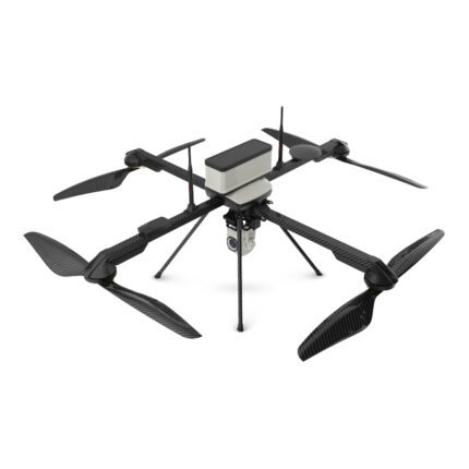
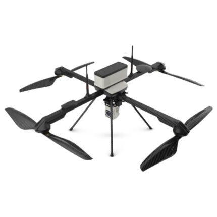
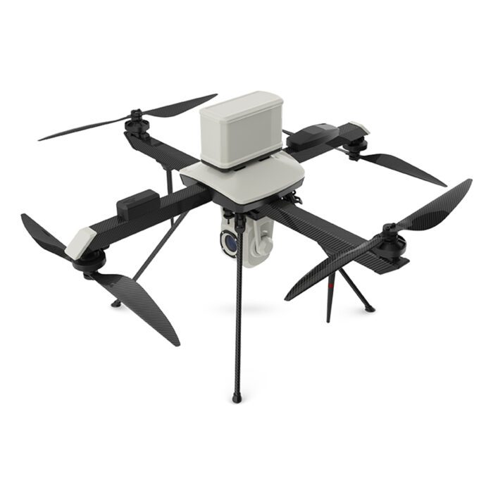
IdeaForge Q4I
₹1,038,400.00
Specifications:
Propulsion: Battery-powered electric propulsion
Maximum Operating Altitude (AGL): 400 m AGL
Maximum Launch Altitude (AMSL): 3000 m AMSL
Functional Temperature Range: 0°C to +50°C
And many more…
- 7 Days Return, Exchange & Refund Policy.
- Free Delivery within 3 to 5 Days.
- Assured Product Quality. We deals with only Genuine Products.
- Peace of mind Warranty. Check Our Warranty Policy.
- Contact Us for Any Assistance.
Guaranteed Safe Checkout
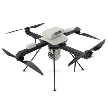
Unveiling The IdeaForge Q4I Drone: Precision, Versatility, And Advanced Technology
The IdeaForge Q4I Drone is a high-performance drone engineered to deliver exceptional capabilities across various industries. Whether you're involved in mapping, surveying, construction, or real estate, the Q4I stands out with its advanced features and robust design. This product description explores the comprehensive specifications and features of the IdeaForge Q4I, comparing it briefly with the IDEAFORGE RYNO and addressing key questions to help you understand its value.
VISIT THIS CATEGORY PAGE TO EXPLORE INDIAN DRONES.
Overview
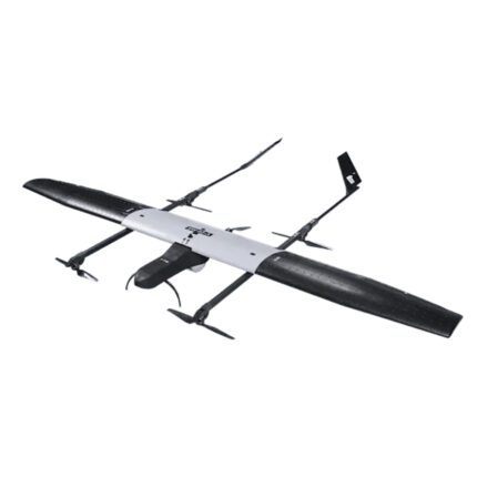
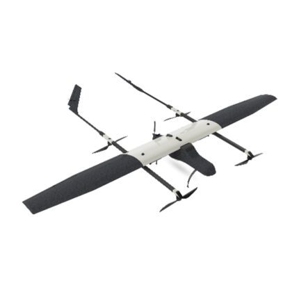
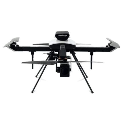
Q4i is ideaForge's one of the most economical small category VTOL UAV. Known for its performance and reliability, Q4i UAV is able to assist in diverse applications such as security and surveillance, traffic management, crowd management and disaster relief applications. The DGCA has issued Type Certification to our Q4i UAV.
Key Specifications Of The IdeaForge Q4I Drone
Aerial Vehicle (AV) Characteristics:
UAV Weight (with battery and max. payload): <3.5 kg
UAV Dimensions: ~80 cm x 80 cm (using propeller)
Endurance (to 1000 m AMSL takeoff): Forty minutes carrying a cargo in daylight
Range of Live Transmission (LOS): 4 km (unobstructed & interference-free)
Typical Cruise Speed: 7 m/s
Propulsion: Battery-powered electric propulsion
Maximum Operating Altitude (AGL): 400 m AGL
Maximum Launch Altitude (AMSL): 3000 m AMSL
Functional Temperature Range: 0°C to +50°C
Dust & Drizzle Resistance: IP53 rating
Aural Signature: <40 dB @ 300 meters AGL
Wind Resistance: Up to 10 m/s (36 km/h or ~20 knots)
UAV Technical Life (Landings): 500 landings minimum
Launch & Recovery: Autonomous Vertical Take-Off & Landing (VTOL)
The maximum Recovery Space Needed: 25 m × 25 m Open Space
Autonomy: Total autonomy without human intervention from launch to landing
Altitude holds, autonomous waypoint navigation, hovering at a designated waypoint, as well as remotely piloted mode (RPV, optional) are the flight modes.
Operating Crew: Maximum of 2
Deployment Time: <10 minutes
Packaging and Storage: Waterproof backpacks with an IP66 rating
Failsafe Features:
- Auto-return home as well as terminate upon a communication breakdown
- Auto return to home as well as shut off the battery on low level
- Multiple GPS for redundancy
- Auto-return to home and land on exceeding wind limit, battery imbalance, or UAV health parameters
Navigation Lights:
- Switchable from GCS
Payload Characteristics:
- Payload Options: Daylight HD (1280x720) with 10x optical zoom, Thermal (320x240 or 640x480), Photogrammetry RX0
- Video Stabilization: Electronic and gimbal stabilization (for surveillance payloads)
- Payload Replacement Time: <5 minutes
- Payload Control (in-flight): Pan 360º, Tilt 90º (with surveillance payload)
- Target Detection Slant Range: Daylight: Minimum 800m; Thermal (640x480): Minimum 400m; Thermal (320x240): Minimum 200m
Ground Control Station (GCS) Software Features:
- 3D Maps: Optional 2D/3D map views, tilt/rotate capability
- GUI Display Parameters: Geographic map, UAV location, trajectory, camera view, waypoints, flight plan
- Maps: Integrate geo-referenced raster maps, 2D maps, SRTM, and DTED elevation data
- Terrain Avoidance: Detects and avoids natural terrain
- Free Hand Annotation: Annotate locations on the map screen
- Geo-Fencing: Create virtual perimeters to prevent UAVs from entering restricted areas
- Channel Scan: Estimates best communication channel
Optional GCS Features:
- Remote Video Streaming: Live video stream to remote locations
- Moving Target Indication: In real-time video, draw attention to moving things.
Recommended GCS Controller Specifications:
- Type: Laptop or Tablet
- Screen Size: Minimum 10" diagonal
- Functional Temperature Range: 0°C to +50°C
- Battery Backup: At least 2 full endurance flights
- IP Rating: IP53
Communication Link Characteristics:
- Capabilities: Transmit control commands, telemetry data, and video
- Encryption: 128-bit AES
- Frequency Band: 2.4GHz or 5GHz
Hope you got to know a lot about the IdeaForge Q4I Specifications. Keep reading!
IdeaForge Q4I Vs. RYNO: An Informational Comparison
When choosing between the IdeaForge Q4I Drone and the IdeaForge RYNO, understanding their key differences can help you select the right drone for your needs.
Weight and Size:
- Q4I: Weighs less than 3.5 kg and measures less than 80 cm x 80 cm.
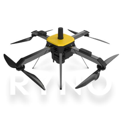
- RYNO: Lighter at less than 2 kg, with a similar size profile of less than 80 cm x 80 cm.
Advantages:
- Q4I: Supports a wider variety of payloads due to its higher weight capacity.
- RYNO: More portable and easier to handle due to its lighter weight.
Disadvantages:
- Q4I: Heavier, which may affect its maneuverability and ease of transport.
- RYNO: Limited in payload capacity compared to the Q4I.
Endurance:
- Both Models: Capable of up to 40 minutes of flight time.
Advantages:
- Both: Provide long flight times suitable for extended missions and comprehensive data collection.
Disadvantages:
- None Specific: Both drones offer equal endurance, making them competitive in this aspect.
Payload Capacity:
- Q4I: Can carry a range of payloads, including high-definition and thermal cameras.
- RYNO: Primarily supports mapping and multispectral imaging payloads.
Advantages:
- Q4I: Greater flexibility with payload options for various applications. The diverse IdeaForge Q4I Applications is another reason for buying this product.
- RYNO: Designed for detailed terrain analysis and mapping.
Disadvantages:
- Q4I: Complex setup with multiple payload options, which can require additional preparation.
- RYNO: Less versatile in payload options, focusing on specialized imaging.
Autonomy and Recovery
- Q4I: Features autonomous Vertical Take-Off and Landing (VTOL).
- RYNO: Offers advanced autonomous capabilities but with different operational specifics.
Advantages:
- Q4I: Simplifies deployment with its VTOL feature, requiring minimal manual intervention.
- RYNO: Provides reliable autonomous flight operations suited for mapping and surveying.
Disadvantages:
- Q4I: Autonomous IdeaForge Q4I Features might involve a steeper learning curve.
- RYNO: Autonomy is tailored more for specific applications like mapping, potentially limiting versatility.
Weather Resistance
- Q4I: IP53 rated with a functional temperature range of 0°C to +50°C.
- RYNO: Also IP53 rated but with a narrower temperature range.
Advantages:
- Q4I: Operates across a broader temperature range, making it adaptable to various environmental conditions.
- RYNO: Effective in challenging weather conditions within its operational range.
Disadvantages:
Q4I: May not perform as well in extreme weather conditions compared to some specialized drones.
RYNO: Slightly limited temperature range may restrict use in very cold or hot environments.
Payload
10X HD Optical Zoom

Thermal Camera with 4X Digital Zoom

The IdeaForge Q4I Drone: More Details
The IdeaForge Q4I Drone emerges as a premier choice for professionals seeking a high-performance drone capable of excelling in various applications, from mapping and surveying to construction and real estate. Its advanced features, such as autonomous vertical take-off and landing (VTOL), extensive payload options, and robust Ground Control Station (GCS) software, make it a versatile and reliable tool for a broad range of industry needs.
The IdeaForge Q4I Drone: Key Highlights
- High IdeaForge Q4I Payload Capacity: The Q4I’s ability to carry a variety of payloads, including high-definition and thermal cameras, sets it apart, providing users with the flexibility to adapt to different operational requirements.
- Extended IdeaForge Q4I Flight Time and Robust Design: With a flight endurance of up to 40 minutes and a weather resistance rating of IP53, the IdeaForge Q4I Drone is designed to perform effectively across a wide range of conditions, although it operates best within its specified temperature range.
- Advanced Autonomy: The autonomous VTOL feature simplifies deployment and recovery, reducing the need for manual intervention and making the drone accessible even for those with limited experience.
- Comprehensive Ground Control Station: The GCS software offers extensive capabilities, including 3D mapping, real-time video streaming, and geo-fencing, enhancing the operational efficiency and situational awareness of users.
In comparison to the IdeaForge RYNO, the IdeaForge Q4I Drone provides enhanced payload versatility and a broader operational temperature range. However, the RYNO remains a valuable option for users who prioritize lighter weight and specialized mapping capabilities. The positive IdeaForge Q4I Review shared by the users of this product speaks volumes about the massive usefulness of this item.
The IdeaForge Q4I Drone: Hurry Up! Call Us To Buy This Product!
Ultimately, the IdeaForge Q4I Drone stands out for its precision, versatility, and advanced technological features, making it a powerful asset for industries demanding high-performance aerial solutions. The high IdeaForge Q4I Performance is another reason to buy this drone. Whether you need detailed surveys, comprehensive inspections, or versatile imaging capabilities, the Q4I offers advanced functionality and reliability to meet diverse operational needs. Are you looking for the latest IdeaForge Q4I Price? If so, contact our sales staff to receive the best rate.
FAQ’s on IdeaForge Q4I
The IdeaForge Q4I Drone offers up to 40 minutes of flight time with a daylight payload.
The IdeaForge Q4I Drone operates effectively within a temperature range of 0°C to +50°C and can handle winds up to 10 m/s.
Key features of the IdeaForge Q4I Drone include autonomous vertical take-off and landing, various payload options, and advanced GCS software with 3D mapping capabilities.
The IdeaForge Q4I Drone supports multiple payloads, including daylight HD, thermal IdeaForge Q4I Camera, and photogrammetry equipment.
The IdeaForge Q4I Drone is powered by a high-capacity battery designed for extended flight times and robust operations. This drone comes with great IdeaForge Q4I Battery Life.
1. We ship our products all over India within 3-5 working days. This includes all 28 states and 8 Union Territories. We do not offer international shipping at this time. We apologize for any inconvenience caused.
2. We ship our products through our delivery partner Shree Tirupati Courier Services PVT. LTD . (http://www.shreetirupaticourier.net/ ) and DTDC Express LTD. (https://www.dtdc.in/index.asp). Shree Tirupati Courier has over 1500 centers in more than 21 states rest are covered by DTDC and its jargon of GPS-connected trucks.
Once we receive an order before 4 pm and we have received the payment at our bank we can process the order the very same day (if it’s a working day i.e. Monday to Saturday). If however, we receive it after 4 pm then we process the order the next working day.
3. As promised on our product page we will bear the entire charges of shipping to your location.
4. It takes around 3-5 working days to deliver the products anywhere in the country. They ship it via the above-mentioned couriers in the surface transit system. However, if you want a quicker delivery you can raise a request by getting in touch with us before placing the order(or within one hour of placing the order) through mail support@www.mavdrones.com or call us at +91 9330328517 We will arrange Air shipping in that case. You will receive the product within 1-3 working days in that case.
5. After shipping we will give you the tracking id within 2 hours of shipping. In case we ship through Shree Tirupati Courier then you can visit http://www.shreetirupaticourier.net/Frm_DocTrack.aspx?docno=%number% This page of them and put your tracking id and can get real-time updates through this tracking platform. However, if we ship through DTDC Express then you need to visit https://www.dtdc.in/tracking.asp for tracking shipping updates.
6. We have several options for sending you the tracking id i.e. we can send it in the mail, WhatsApp, or telegram.
7. If you have any problems with the delivery like:
7A. Delayed shipment: If the shipment is delayed by any chance of any more than 3-5 working days then you have the right to demand a full refund which will be processed as per our refund policy which you can see at our RETURNS< EXCHANGES AND REFUNDS POLICY or if you are willing to cooperate with us then we can enquire with the shipping company and try and find out why the delay is happening. In the latter case, we can either work with the shipping company and try and deliver the transiting item as soon as possible or we can ship a new product to your location through a different courier partner.
7B. Receiving a broken item: We strongly suggest you should make an unboxing video of the product and also keep recording till you successfully fly the drone. Therefore, if you receive a broken item we can identify it from the video and can process a RETURN, EXCHANGE, or Refund as per your wish.
8. Public Holidays and Force Majeure:
Please note that the delivery timeframe may be affected during public holidays and unforeseen circumstances beyond our control (Such as natural disasters, strikes, or transportation disruptions). We appreciate your understanding in such situations.











Reviews
Clear filtersThere are no reviews yet.