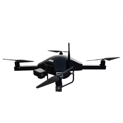
IdeaForge NINJA UAV Drone
₹649,000.00
Specifications:
Typical Cruise Speed: 7 m/s
Propulsion: Battery-powered electric propulsion
Maximum Operating Altitude (AGL): 200 m
Maximum Launch Altitude (AMSL): 2500 m
And many more…
- 7 Days Return, Exchange & Refund Policy.
- Free Delivery within 3 to 5 Days.
- Assured Product Quality. We deals with only Genuine Products.
- Peace of mind Warranty. Check Our Warranty Policy.
- Contact Us for Any Assistance.
Guaranteed Safe Checkout
Discover The Ideaforge NINJA UAV Drone: Revolutionizing Aerial Technology
In the ever-evolving landscape of unmanned aerial vehicles (UAVs), the IdeaForge NINJA Drone emerges as a high-performance and adaptable solution. Whether you’re engaged in professional surveillance, aerial photography, or technical inspections, the NINJA UAV Drone offers a blend of cutting-edge technology and practical features that set it apart. Here’s a comprehensive look at why the NINJA Unmanned Aerial Vehicle is a standout choice and how it can meet your specific needs.
VISIT THIS CATEGORY PAGE TO KNOW MORE ABOUT INDIAN DRONES.
What Is The IdeaForge NINJA UAV Drone?
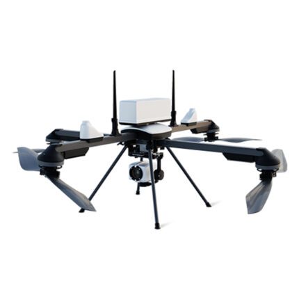
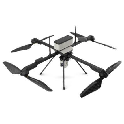
The IdeaForge NINJA UAV Drone is a state-of-the-art drone designed to deliver exceptional performance across a range of applications. With its advanced features, robust build, and user-friendly design, this UAV is ideal for both commercial and professional use. It excels in providing reliable aerial solutions, particularly in demanding environments.
Key Specifications
Here’s an in-depth look at the technical specifications that define the NINJA UAV Drone:
Aerial Vehicle (AV) Characteristics:
- UAV Weight with Battery and Max Payload: Less than 2 kg
- UAV Size with Propeller: Less than 80 cm x 80 cm
- Endurance: 20-25 minutes with payload (up to 1000 m AMSL Take-Off)
- Range of Live Transmission (LOS): 2 km (unobstructed & interference-free)
- Typical Cruise Speed: 7 m/s
- Propulsion: Battery-powered electric propulsion
- Maximum Operating Altitude (AGL): 200 m
- Maximum Launch Altitude (AMSL): 2500 m
- Functional Temperature Range: 0°C to +40°C
- Dust & Drizzle Resistance: IP 53 rating
- Aural Signature: Less than 40 dB @300 meters AGL
- Wind Resistance: Up to 10 m/s (36 km/h or ~20 knots)
- Technical Life of UAV (Landings): Minimum 500 landings
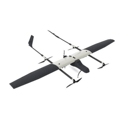
- Launch & Recovery: Autonomous Vertical Take-Off & Landing (VTOL)
- Maximum Space Required for Recovery: 25 m x 25 m open area
- Autonomy: Fully autonomous from takeoff to landing
- Flight Modes:
- Altitude Hold Hover
- Autonomous Waypoint Navigation (pre-defined and dynamically adjustable)
- Remotely Piloted Mode (RPV Mode)
- Operating Crew: Maximum of 2
- Deployment Time: Less than 10 minutes
- Packaging and Storage: waterproof backpacks with an IP66 rating
- Failsafe Features: Includes Auto-Return to Home and Land on various failures (communication, low battery, wind limit, battery imbalance, UAV health parameters).
- Navigation Lights: Switchable from Ground Control Station (GCS)
Payload Characteristics:
- Payload Options:
- Daylight HD (1280x720) with 5x optical zoom
- Thermal 320x240 video (Optional)
- Photogrammetry RX0 payload, fixed mount (Optional)
- Video Stabilization: Electronic and gimbal stabilization (Applicable with surveillance payload)
- Payload Replacement Time: Less than 5 minutes
- Payload Control (In-flight):
- Pan: 360º continuous (with UAV)
- Tilt: 90º (Only with surveillance payload)
- Target Detection Slant Range (Human Size Target):
- Daylight: Minimum 400 m
- Thermal (320x240): Minimum 200 m
Ground Control Station (GCS) Software Features:
- 3D Maps: Optional 2D/3D map views with tilt/rotate capability
- GUI Display Parameters:
- Geographic Map, UAV location, trajectory, waypoints
- Real-time video, UAV coordinates, target coordinates, distance from home
- Maps Integration: Capability to work with open-source maps and integrate geo-referenced raster maps and elevation data
- Terrain Avoidance: Uses elevation data for natural terrain detection
- Free Hand Annotation: Annotate locations on the map screen
- Terrain Hugging: Maintain altitude over non-uniform terrain
- No Fly Zone & Geo Fencing: Mark restricted zones and create virtual boundaries
- User Controls: Take-off/Land, altitude setting, waypoint navigation, dynamic flight plan adjustment
- Joystick Controls: Full camera controls (Pan/Tilt & Zoom In/Out, applicable for surveillance)
- Video Recording: Recorded on GCS, with options to export in AVI/MP4 and take image snapshots
- Pre-flight Checks: Comprehensive system checks before flight
- Telemetry Data Logging: Essential data logging and flight path export in .kml format
Optional GCS Features:
- Remote Video Streaming: Stream live video over the Internet or local network (Applicable for surveillance)
- Moving Target Indication: Highlight moving objects in live video (Applicable for surveillance)
Recommended GCS Controller Specification:
- Type: Laptop or Tablet
- Screen Size: Minimum 10" diagonal
- Functional Temperature Range: 0°C to +40°C
- GCS Controller Battery Backup: At least 2 full endurance flights
Communication Link Characteristics:
- Capabilities: Transmit control commands, telemetry data, and video
- Encryption: 128-bit AES encryption
- Frequency Band: 5 GHz
Are you looking for the latest Ideaforge NINJA UAV Price? If so, contact our sales team to get the best rate.
How The IdeaForge NINJA UAV Drone Excels In Surveillance
The IdeaForge NINJA Drone is a leading choice for surveillance operations, thanks to its cutting-edge technology and specialized features. Here's an in-depth look at how the NINJA Unmanned Aerial Vehicles stand out in the field of surveillance:
High-Resolution Imaging
The NINJA UAV Drone comes equipped with advanced imaging capabilities that are pivotal for effective surveillance. It features:
- Daylight HD Camera: This high-definition camera offers crisp and clear visuals at a resolution of 1280x720. The camera’s ability to capture detailed footage ensures that every aspect of the monitored area is visible, making it easier to spot and track objects of interest.
- Optional Thermal Payload: For operations in low-light or complete darkness, the optional thermal imaging payload provides infrared video capture. With a resolution of 320x240, this thermal camera can detect heat signatures, allowing for surveillance in various environmental conditions and enhancing the ability to identify targets that are otherwise invisible to standard cameras.
These imaging options make the NINJA UAV Drone versatile for both day and night surveillance, ensuring comprehensive monitoring regardless of the lighting conditions.
Advanced Stabilization
To ensure high-quality footage and reliable data, the NINJA UAV Drone incorporates sophisticated stabilization technology:
- Electronic Stabilization: This feature minimizes the impact of vibrations and minor movements, keeping the video feed steady and clear. It helps in capturing stable, high-definition footage, which is crucial for accurate surveillance and analysis.
- Gimbal Stabilization: For further enhancement, the drone employs a gimbal system that actively adjusts the camera's orientation to counteract any additional movement. This ensures that the camera remains level and focused, providing smooth video even during dynamic flight maneuvers.
These stabilization systems are essential for maintaining the quality and reliability of the footage, especially when dealing with high-speed flights or challenging weather conditions.
Autonomous Operation
The NINJA UAV Drone excels in autonomous flight, which is crucial for seamless surveillance operations:
- Fully Autonomous Flight: This NINJA Drone is capable of executing complex flight patterns and missions without manual intervention. This includes autonomous vertical take-off and landing (VTOL) and waypoint navigation, which allows the UAV to follow pre-defined or dynamically adjusted flight paths with precision.
- Reduced Manual Intervention: By minimizing the need for constant operator control, the NINJA UAV Drone enables continuous surveillance coverage. This autonomy allows operators to focus on analyzing the data rather than managing the flight, enhancing overall efficiency and effectiveness.
This autonomous capability makes the NINJA Unmanned Aerial Vehicles ideal for long-duration surveillance missions and situations where constant operator presence is impractical.
Real-Time Data Transmission
Effective surveillance relies on timely and accurate data transmission, and the NINJA UAV Drone delivers on this front:
- Live Video Feed: This NINJA Drone transmits real-time video directly to the Ground Control Station (GCS). This live feed allows operators to monitor the surveillance area as it happens, facilitating immediate decision-making and response.
- Telemetry Data: Alongside video, the UAV also transmits important telemetry data, including GPS coordinates, altitude, and flight status. This data provides valuable context for the video feed, helping operators to track and interpret the situation more effectively.
The combination of live video and telemetry ensures that operators have a comprehensive view of the operational environment, improving situational awareness and enhancing the effectiveness of surveillance efforts.
Overall, the IdeaForge NINJA UAV Drone is engineered to meet the demands of modern surveillance with its high-resolution imaging, advanced stabilization, autonomous operation, and real-time data transmission. These features collectively ensure that the UAV provides detailed, stable, and actionable intelligence, making it a powerful tool for various surveillance applications.
Are you looking for the latest Ideaforge NINJA UAV Price? If so, contact our sales team to get the best rate.
Important Questions About The IdeaForge NINJA UAV Drone
If you’re exploring the IdeaForge NINJA UAV Drone for your operations, here are some key questions that can help you understand its capabilities and advantages:
How Does The IdeaForge NINJA UAV Drone Handle Different Flight Conditions?
The IdeaForge NINJA Drone is engineered to perform reliably across a range of flight conditions:
- Altitude Performance: It operates effectively up to 200 meters above ground level and can be launched from altitudes of up to 2500 meters above mean sea level, making it suitable for various terrains and elevations.
- Wind Resistance: With a wind resistance capability of up to 10 m/s (approximately 36 km/h or 20 knots), the UAV remains stable even in moderate winds, ensuring reliable flight performance.
- Temperature Tolerance: The UAV functions within a temperature range of 0°C to +40°C, allowing it to operate in a variety of environmental conditions. It is designed to handle dust and light drizzle, thanks to its IP53 rating.
What Kind Of Ground Control And Data Analysis Features Are Available With The NINJA UAV Drone?
The IdeaForge NINJA Unmanned Aerial Vehicles offer a sophisticated Ground Control Station (GCS) with several advanced features:
- 3D and 2D Mapping: Optional 3D map views allow for detailed navigation and planning. Users can switch between 2D and 3D views and annotate maps for precise control.
- Real-Time Data: The GCS provides real-time video feed and telemetry data, including UAV location, trajectory, and camera views, which are crucial for effective surveillance and mission management.
- Terrain Avoidance and Geo Fencing: The UAV’s GCS includes terrain avoidance capabilities to prevent collisions with natural terrain and geo-fencing features to define no-fly zones or boundaries for safe operations.
How Does The NINJA UAV Drone Ensure Mission Reliability And Safety?
The IdeaForge NINJA UAV Drone incorporates several safety and reliability features:
- Failsafe Mechanisms: Includes auto-return to home on communication failure, low battery, and exceeding wind limits, as well as multiple onboard GPS for redundancy. These features help ensure the UAV returns safely in case of issues.
- Technical Life: The UAV is designed for a minimum of 500 landings, supporting long-term usage and durability.
- Autonomous Operation: It offers fully autonomous flight capabilities from take-off to landing, reducing the risk of human error and enhancing operational reliability.
How Customizable Are The Payload Options For The NINJA UAV Drone?
The IdeaForge NINJA UAV Drone supports a range of payloads to cater to various operational needs:
- Daylight HD Camera: Provides 1280x720 resolution with 5x optical zoom for detailed visual surveillance.
- Thermal Camera: Optional 320x240 thermal imaging payload for detecting heat signatures, useful for night operations and visibility through obstacles.
- Photogrammetry Payloads: Optional fixed-mount payloads for high-precision mapping and surveying.
Payloads can be replaced in less than 5 minutes, allowing quick adaptation to different mission requirements.
What Is The Deployment And Recovery Process Like For The NINJA UAV Drone?
The deployment and recovery of the IdeaForge NINJA UAV Drone are designed to be efficient and straightforward:
- Deployment Time: The UAV can be set up and ready for flight in less than 10 minutes, ensuring rapid initiation of missions.
- Recovery Space: Requires a minimum open area of 25m x 25m for safe landing and recovery, accommodating various operational environments.
How Does The NINJA UAV Drone Manage Real-Time Video And Data Transmission?
The IdeaForge NINJA UAV Drone excels in data transmission with:
- Secure Communication: Utilizes 128-bit AES encryption for secure transmission of control commands, telemetry data, and video feeds.
- Real-Time Streaming: Provides live video streaming to the Ground Control Station, ensuring continuous monitoring and timely decision-making during operations.
What Are The Primary Applications For The IdeaForge NINJA UAV Drone?
The IdeaForge NINJA UAV Drone is highly versatile and suited for various applications:
- Surveillance: With its high-resolution and thermal imaging capabilities, it is ideal for security and surveillance tasks, including monitoring large areas and detecting heat signatures.
- Mapping and Surveying: The photogrammetry payload options make it suitable for detailed mapping and land surveying.
- Inspection: Its stable flight and high-quality imaging are useful for inspecting infrastructure, such as power lines and buildings.
Overall, the IdeaForge NINJA UAV Drone stands out for its reliability, advanced features, and flexibility, making it a valuable tool for a range of professional applications.
Are you looking for the latest NINJA UAV Drone Price? If so, contact our sales team to get the best rate.
More Details
The IdeaForge NINJA UAV Drone represents a significant advancement in unmanned aerial technology, offering a versatile and robust solution for a variety of professional applications. Designed with both innovation and practicality in mind, the NINJA UAV Drone excels in delivering high-performance aerial capabilities tailored to meet the demands of modern operations.
Know More
Exceptional Performance
The NINJA UAV’s high-resolution imaging systems, including its Daylight HD and optional thermal payloads, ensure that it can deliver clear and detailed visuals across a range of lighting conditions. This makes it particularly effective for surveillance, mapping, and inspection tasks.
Advanced Stabilization and Autonomy
With state-of-the-art electronic and gimbal stabilization, the UAV guarantees smooth and stable video capture, even in challenging conditions. Its fully autonomous flight capabilities reduce the need for manual control, allowing for continuous, reliable operations.
Comprehensive Data Transmission
The UAV’s ability to provide real-time video and telemetry data enhances situational awareness and decision-making. Secure communication channels and live streaming features ensure that critical information is transmitted efficiently and securely.
Flexible and Customizable Payloads
The NINJA UAV’s range of payload options, including high-definition cameras and thermal imaging, can be quickly swapped to adapt to different mission requirements. This flexibility is crucial for addressing diverse operational needs.
Efficient Deployment and Recovery
Designed for rapid setup and recovery, the UAV can be operational within minutes and requires minimal space for landing. This efficiency supports fast-paced, dynamic environments.
Reliable and Safe Operations
Built with multiple failsafe mechanisms and a robust technical life, the NINJA Unmanned Aerial Vehicles ensure mission reliability and safety. Its ability to handle various environmental conditions further enhances its operational versatility.
Buy This Product Now!
The IdeaForge NINJA UAV Drone stands out as a powerful tool for professionals seeking advanced aerial solutions. Its combination of high-performance imaging, autonomous capabilities, and real-time data transmission makes it a valuable asset for surveillance, mapping, and inspection tasks. Whether you’re conducting security operations, performing technical inspections, or engaging in detailed mapping, the NINJA Drone offers the technology and reliability needed to achieve your goals efficiently and effectively.
Are you looking for the latest Ideaforge NINJA UAV Price? If so, contact our sales team to get the best rate.
1. We ship our products all over India within 3-5 working days. This includes all 28 states and 8 Union Territories. We do not offer international shipping at this time. We apologize for any inconvenience caused.
2. We ship our products through our delivery partner Shree Tirupati Courier Services PVT. LTD . (http://www.shreetirupaticourier.net/ ) and DTDC Express LTD. (https://www.dtdc.in/index.asp). Shree Tirupati Courier has over 1500 centers in more than 21 states rest are covered by DTDC and its jargon of GPS-connected trucks.
Once we receive an order before 4 pm and we have received the payment at our bank we can process the order the very same day (if it’s a working day i.e. Monday to Saturday). If however, we receive it after 4 pm then we process the order the next working day.
3. As promised on our product page we will bear the entire charges of shipping to your location.
4. It takes around 3-5 working days to deliver the products anywhere in the country. They ship it via the above-mentioned couriers in the surface transit system. However, if you want a quicker delivery you can raise a request by getting in touch with us before placing the order(or within one hour of placing the order) through mail support@www.mavdrones.com or call us at +91 9330328517 We will arrange Air shipping in that case. You will receive the product within 1-3 working days in that case.
5. After shipping we will give you the tracking id within 2 hours of shipping. In case we ship through Shree Tirupati Courier then you can visit http://www.shreetirupaticourier.net/Frm_DocTrack.aspx?docno=%number% This page of them and put your tracking id and can get real-time updates through this tracking platform. However, if we ship through DTDC Express then you need to visit https://www.dtdc.in/tracking.asp for tracking shipping updates.
6. We have several options for sending you the tracking id i.e. we can send it in the mail, WhatsApp, or telegram.
7. If you have any problems with the delivery like:
7A. Delayed shipment: If the shipment is delayed by any chance of any more than 3-5 working days then you have the right to demand a full refund which will be processed as per our refund policy which you can see at our RETURNS< EXCHANGES AND REFUNDS POLICY or if you are willing to cooperate with us then we can enquire with the shipping company and try and find out why the delay is happening. In the latter case, we can either work with the shipping company and try and deliver the transiting item as soon as possible or we can ship a new product to your location through a different courier partner.
7B. Receiving a broken item: We strongly suggest you should make an unboxing video of the product and also keep recording till you successfully fly the drone. Therefore, if you receive a broken item we can identify it from the video and can process a RETURN, EXCHANGE, or Refund as per your wish.
8. Public Holidays and Force Majeure:
Please note that the delivery timeframe may be affected during public holidays and unforeseen circumstances beyond our control (Such as natural disasters, strikes, or transportation disruptions). We appreciate your understanding in such situations.












Reviews
Clear filtersThere are no reviews yet.