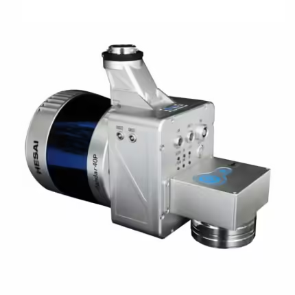
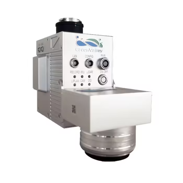
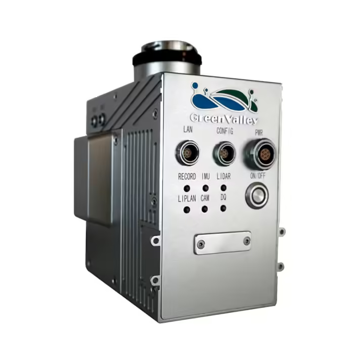
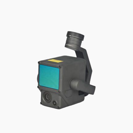
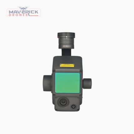
GreenValley LiAir V70
₹2,006,000.00
Specifications:
Laser Sensor: Livox AVIA
Range Accuracy: ±2 cm
Detection Range (@100klx)
System Accuracy: ±5 cm
POS System Performance
And many more…
- 7 Days Return, Exchange & Refund Policy.
- Free Delivery within 3 to 5 Days.
- Assured Product Quality. We deals with only Genuine Products.
- Peace of mind Warranty. Check Our Warranty Policy.
- Contact Us for Any Assistance.
Guaranteed Safe Checkout
Introducing The GreenValley LiAir V70: The Pinnacle Of LiDAR Precision
The GreenValley LiAir V70 represents the cutting edge of LiDAR technology, combining advanced features and exceptional performance to meet the diverse needs of professionals across various industries. This state-of-the-art system is designed to deliver unparalleled accuracy and efficiency, making it an essential tool for high-precision mapping, surveying, and monitoring applications.
GreenValley LiAir V70: Unmatched Precision And Range
At the heart of the V70 is the Livox AVIA laser sensor, renowned for its superior range accuracy of ±2 cm and system accuracy of ±5 cm. Whether you're working with reflectance as low as 10% or as high as 80%, the 70V delivers reliable measurements with a detection range extending up to 450 meters. This precision is crucial for tasks such as topographic mapping and infrastructure monitoring, where exact data is essential for making informed decisions and ensuring project accuracy.
GreenValley LiAir V70: Versatile Compatibility And Mounting Options
The GreenValley LiAir V70 is compatible with a range of DJI drones, including the Matrice 600 Pro, M300 RTK, and M210, offering flexibility in deployment. This compatibility ensures that users can integrate the 70V into their existing UAV setups with ease, enhancing the utility of their aerial platforms for complex data collection tasks. The system's lightweight design—0.9 kg without the camera and 1.1 kg with the optional Sony A5100 camera—ensures minimal impact on drone performance while maximizing data collection capabilities.
GreenValley LiAir V70: Comprehensive Data Acquisition And Processing
Equipped with onboard storage of 128 GB, the LiAir V70 can handle extensive data sets without the need for frequent data transfers. The system's acquisition and processing capabilities are further enhanced by GreenValley’s proprietary LiAcquire Web and LiGeoreference software, which streamline data management and georeferencing tasks. This software suite supports efficient data processing, allowing users to quickly analyze and visualize their findings.
GreenValley LiAir V70: Superior Field Of View And Scan Rate
With a field of view of 70.4° horizontal and 4.5° vertical, the V70 covers extensive areas with high detail. The scan rate of 240,000 points per second and a maximum of 720,000 points per second with triple return ensures that the system captures an extensive amount of data in a single pass. This capability is particularly valuable for large-scale projects such as urban planning, environmental monitoring, and infrastructure inspections, where comprehensive data coverage is crucial.
Technical Specifications Of The GreenValley LiAir V70
The GreenValley LiAir V70 is a state-of-the-art LiDAR system designed for high-performance aerial data collection. Here is a thorough rundown of its features:
Laser Sensor: Livox AVIA
The LiAir 70V utilizes the Livox AVIA laser sensor, known for its high precision and reliability in capturing detailed LiDAR data.
Range Accuracy: ±2 cm
This level of accuracy ensures that the measurements obtained are highly precise, with minimal deviation from the actual values.
Detection Range (@100klx):
190 m @ 10% reflectance: The LiAir 70V can detect objects up to 190 meters away with 10% reflectance, making it suitable for various applications where medium-range detection is required.
450 m @ 80% reflectance: At higher reflectance levels, the sensor’s detection range extends up to 450 meters, providing greater flexibility in capturing distant targets.
System Accuracy: ±5 cm
The overall system accuracy reflects the precision of the data collected by the LiAir 70V, allowing for reliable and detailed surveys.
POS System Performance:
Attitude: 0.008° (1σ)
Azimuth: 0.038° (1σ)
These figures represent the precision in measuring the orientation of the LiAir 70V, contributing to accurate data collection and positioning.
Onboard Storage: 128 GB
A substantial amount of onboard storage allows for extensive data collection without frequent data transfers.
Working Temperature: -20 ℃ to 40℃
The 70V is designed to operate effectively in a broad temperature range, ensuring reliability in various environmental conditions.
Platform for mounting: DJI Matrice 600 Pro, M300 RTK, as well as M210
Compatible with several DJI Matrice models, the LiAir 70V enhances these drones' capabilities with its advanced LiDAR technology.
Camera (Optional): Sony A5100
The optional Sony A5100 camera can be integrated for capturing high-resolution imagery alongside LiDAR data.
Weight:
0.9 kg (Excl. Camera)
1.1 kg (Incl. Camera)
The lightweight design facilitates easy mounting on UAVs and ensures efficient flight performance.
Dimensions (Incl. Camera): 178 x 81.6 x 140.2 mm
Compact dimensions allow for a streamlined design that minimizes drag and optimizes LiDAR Drone performance.
Acquisition/PP POS Software: LiAcquire Web & LiGeoreference
The accompanying software tools provide essential functionalities for data acquisition, processing, and georeferencing, ensuring high-quality and actionable results.
Viewing angle: 70.4° horizontally x 4.5° vertically
A wide field of view enables comprehensive data capture over large areas, enhancing the efficiency of surveys and inspections.
Scan Rate: 240,000 pts/s
The high scan rate allows for rapid data collection, which is crucial for covering extensive areas in a shorter time.
Maximum Points/Second: 720,000 points/s (return triple)
With the capability to capture up to 720,000 points per second, the LiAir 70V delivers extremely detailed and accurate LiDAR data.
The GreenValley LiAir V70 is a high-performance LiDAR system tailored for precise and efficient data collection, making it a valuable tool for a range of professional applications across various industries.
GreenValley LiAir V70: Extreme Operating Conditions
The GreenValley LiAir V70 is designed to operate in a wide range of temperatures, from -20°C to 40°C, making it suitable for diverse environmental conditions. This durability ensures that the 70V performs reliably in challenging weather and operational scenarios, enhancing its versatility and dependability in various field conditions.
GreenValley LiAir V70: Ideal For Multiple Industries
The LiAir 70V is a versatile tool applicable across numerous industries. In construction and civil engineering, it provides detailed topographic maps and accurate measurements for project planning and monitoring. Environmental scientists and conservationists use it for detailed surveys of natural landscapes and resource assessments.
The system's ability to integrate seamlessly with various DJI drones and its high performance make it an invaluable asset for professionals seeking precision and efficiency in their LiDAR data collection. For those seeking a powerful, accurate, and versatile LiDAR system, the GreenValley LiAir V70 stands out as a premier choice. Explore its advanced features and discover how it can elevate your data collection and analysis capabilities.
GreenValley LiAir V70: Seamless Compatibility With Matrice Series Drones
The GreenValley LiAir V70 is designed to integrate effortlessly with DJI's Matrice series drones, including the MATRICE 600 PRO, M300 RTK, and M350 RTK. This compatibility ensures that users can leverage the powerful capabilities of these UAV platforms while enhancing them with the 70V's advanced LiDAR technology.
The Matrice series drones are renowned for their robust flight performance, stability, and payload capacity, making them ideal for mounting high-precision sensors like the 70V. This integration allows for seamless operation, enabling users to deploy the LiAir 70V quickly and effectively without the need for extensive modifications or additional equipment.
The Matrice 600 Pro, with its heavy-lift capability, is particularly suited for carrying the LiAir V70, supporting its extensive data collection range and high scan rates. The M300 RTK, known for its advanced RTK capabilities and rugged design, offers precise positioning and enhanced data accuracy, making it an excellent choice for professional surveying and mapping applications when paired with the 70V. The M210's flexibility in payload configuration and its ability to handle various sensors further complement the 70V's capabilities, making it a versatile option for different mission requirements.
GreenValley LiAir V70: Broad Industry Applications
The LiAir V70 excels across various industries, offering tailored solutions for specific professional needs:
Construction and Civil Engineering: The V70's high accuracy and extensive field of view make it ideal for large-scale construction projects. It provides detailed topographic maps and 3D models essential for site planning, progress monitoring, and quality control. Engineers and surveyors benefit from its ability to capture intricate details and generate accurate measurements, facilitating efficient project execution and management.
Environmental Monitoring and Conservation: For environmental scientists and conservationists, the V70 provides critical data for habitat mapping, vegetation analysis, and resource management. Its precise measurements and wide detection range are valuable for assessing environmental changes, monitoring deforestation, and conducting ecological surveys. The 70V’s ability to operate in varying weather conditions and temperatures makes it a reliable tool for fieldwork in diverse environments.
Urban Planning and Infrastructure Inspection: Urban planners and infrastructure inspectors use the V70 to create detailed 3D models of cityscapes and infrastructure. This data is crucial for analyzing urban growth, planning new developments, and conducting maintenance inspections. The system’s high scan rate and extensive data capacity enable comprehensive coverage of large areas, providing valuable insights for effective urban management.
Mining and Quarrying: In the mining sector, the LiAir 70V aids in surveying and mapping mineral deposits, assessing quarry volumes, and monitoring excavation progress. Its accuracy and ability to capture detailed surface information support efficient resource management and operational planning.
Agriculture and Land Management: The V70 is also beneficial for precision agriculture, where it assists in creating accurate land surveys, monitoring crop health, and managing irrigation systems. Its high-resolution data helps farmers and land managers make informed decisions to optimize agricultural practices and improve land use.
GreenValley LiAir V70: Limited Stocks Available! Call Us Now!
Overall, the GreenValley LiAir V70 is a versatile and powerful LiDAR system that enhances the capabilities of DJI’s Matrice series drones. Its compatibility with these drones, combined with its high performance and broad range of applications, makes it an indispensable tool for professionals seeking precision and reliability in their data collection and analysis tasks.
1. We ship our products all over India within 3-5 working days. This includes all 28 states and 8 Union Territories. We do not offer international shipping at this time. We apologize for any inconvenience caused.
2. We ship our products through our delivery partner Shree Tirupati Courier Services PVT. LTD . (http://www.shreetirupaticourier.net/ ) and DTDC Express LTD. (https://www.dtdc.in/index.asp). Shree Tirupati Courier has over 1500 centers in more than 21 states rest are covered by DTDC and its jargon of GPS-connected trucks.
Once we receive an order before 4 pm and we have received the payment at our bank we can process the order the very same day (if it’s a working day i.e. Monday to Saturday). If however, we receive it after 4 pm then we process the order the next working day.
3. As promised on our product page we will bear the entire charges of shipping to your location.
4. It takes around 3-5 working days to deliver the products anywhere in the country. They ship it via the above-mentioned couriers in the surface transit system. However, if you want a quicker delivery you can raise a request by getting in touch with us before placing the order(or within one hour of placing the order) through mail support@www.mavdrones.com or call us at +91 9330328517 We will arrange Air shipping in that case. You will receive the product within 1-3 working days in that case.
5. After shipping we will give you the tracking id within 2 hours of shipping. In case we ship through Shree Tirupati Courier then you can visit http://www.shreetirupaticourier.net/Frm_DocTrack.aspx?docno=%number% This page of them and put your tracking id and can get real-time updates through this tracking platform. However, if we ship through DTDC Express then you need to visit https://www.dtdc.in/tracking.asp for tracking shipping updates.
6. We have several options for sending you the tracking id i.e. we can send it in the mail, WhatsApp, or telegram.
7. If you have any problems with the delivery like:
7A. Delayed shipment: If the shipment is delayed by any chance of any more than 3-5 working days then you have the right to demand a full refund which will be processed as per our refund policy which you can see at our RETURNS< EXCHANGES AND REFUNDS POLICY or if you are willing to cooperate with us then we can enquire with the shipping company and try and find out why the delay is happening. In the latter case, we can either work with the shipping company and try and deliver the transiting item as soon as possible or we can ship a new product to your location through a different courier partner.
7B. Receiving a broken item: We strongly suggest you should make an unboxing video of the product and also keep recording till you successfully fly the drone. Therefore, if you receive a broken item we can identify it from the video and can process a RETURN, EXCHANGE, or Refund as per your wish.
8. Public Holidays and Force Majeure:
Please note that the delivery timeframe may be affected during public holidays and unforeseen circumstances beyond our control (Such as natural disasters, strikes, or transportation disruptions). We appreciate your understanding in such situations.











Reviews
Clear filtersThere are no reviews yet.