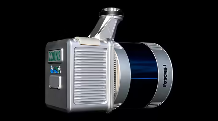
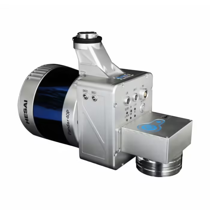
GreenValley LiAir 220N
₹7,080,000.00
Specifications:
Laser Sensor: Hesai Pandar40P
Range Accuracy: ±2 cm
Detection Range: 100 m @ 10% reflectance
Channels: 40
Power Consumption: 27 W
System Accuracy: ± 5 cm
And many more…
- 7 Days Return, Exchange & Refund Policy.
- Free Delivery within 3 to 5 Days.
- Assured Product Quality. We deals with only Genuine Products.
- Peace of mind Warranty. Check Our Warranty Policy.
- Contact Us for Any Assistance.
Guaranteed Safe Checkout
GreenValley LiAir 220N: Your Ultimate Green LiDAR Solution
The GreenValley LiAir 220N is a cutting-edge aerial LiDAR (Light Detection and Ranging) system, specifically designed for precise and efficient data acquisition. This compact, lightweight unit leverages advanced Green LiDAR technology to provide industry professionals with top-tier 3D mapping and modeling capabilities. If you're searching for the latest in LiDAR innovation, the LiAir GreenValley 220N is a powerful tool that's suitable for a wide range of industries, from environmental monitoring to urban planning.
VISIT THIS CATEGORY PAGE TO EXPLORE MORE SUCH PRODUCTS.
Specifications Of The GreenValley LiAir 220N
- Laser Sensor: Hesai Pandar40P
- Range Accuracy: ±2 cm
- Detection Range: 100 m @ 10% reflectance
- Channels: 40
- Power Consumption: 27 W
- System Accuracy: ± 5 cm
- Performance of the POS system: Azimuth: 0.038° (1σ), attitude: 0.008° (1σ)
- Working Temperature: -20℃ to 40℃
- Platforms for mounting: DJI Matrice 600 Pro and M300 RTK
- Camera (Optional): Sony A5100
- Weight: 2 kg (including the camera)
- Dimensions: 234 x 100 x 181 mm (including the camera)
- Acquisition/PP POS Software: LiAcquire Web & LiGeoreference
- Field of View: 360° (Horizontal), 40° (Vertical)
- Scan Rate: 720,000 points (Single Return), 1,440,000 points (Dual Return)
Highly Integrated Design
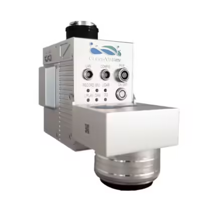
Simplifies equipment operation with indicator lights, making it more user-friendly. The system uses a pluggable TF card for storage and adopts an engineering data storage mode, allowing for one-time copying of laser and camera data and one-click processing.
Mapping Camera with Ultra-HD Quality
The system includes a built-in 26MP high-resolution mapping camera and reserves an external camera interface, supporting multiple camera types, such as infrared cameras, to meet various mapping product requirements.

GreenValley LiAir 220N: Utility And Versatility Across Industries
The GreenValley LiAir 220N offers remarkable utility across various industries, thanks to its precise performance and adaptable design. Its high accuracy and fast data acquisition make it indispensable for:
Surveying and Mapping: Ideal for topographic surveys and 3D mapping of landscapes, this system excels in capturing highly accurate data.
Forestry and Environmental Monitoring: The Green LiDAR capabilities allow it to penetrate dense vegetation, making LiAir GreenValley 220N a critical tool for forest inventory, canopy height analysis, and environmental conservation efforts.
Urban Planning and Infrastructure: It’s an excellent choice for generating detailed maps and models of cities, construction sites, and transport networks, enabling planners to visualize and analyze urban environments more effectively.
Mining and Geology: The LiAir 220N delivers reliable data in challenging terrains, helping geologists and mining professionals analyze rock formations, quarry landscapes, and mine safety conditions with high precision.
GreenValley LiAir 220N: Compatibility And Ease Of Use
The GreenValley LiAir 220N is designed to seamlessly integrate with popular drone platforms like DJI’s Matrice 600 Pro and M300 RTK. Its lightweight construction (only 2 kg including the camera) ensures that it can be easily mounted on these drones for efficient airborne surveys. Additionally, with an operational temperature range of -20℃ to 40℃, the system is built to perform in diverse environments, from cold mountain ranges to hot deserts.
For those seeking even greater versatility, the GreenValley LiAir 220N system offers optional camera integration (such as the Sony A5100), enabling users to capture high-resolution images alongside LiDAR data, making it perfect for creating photorealistic 3D models.
GreenValley LiAir 220N: Powerful Software Integration
The LiAcquire Web and LiGeoreference software make post-processing and data management a breeze. These programs allow users to easily control the GreenValley LiAir 220N system, acquire data, and georeference the collected information to create accurate, actionable insights. The streamlined workflow, from data acquisition to final model creation, reduces the time spent on manual processing and enhances the overall project efficiency. The affordable Green Valley LiDAR Price makes this product worth buying.
Supports LiPIan Flight Assistant
Enables operation status monitoring, device parameter configuration, and real-time 3D point cloud display. The new interface design offers a more user-friendly flight operation experience.

Why Choose The GreenValley LiAir 220N?
With the GreenValley LiAir 220N, you’re investing in a system that delivers exceptional performance at a competitive price point within the Green LiDAR market. Whether you're working in natural resource management, urban infrastructure, or any other data-intensive industry, this aerial LiDAR solution provides unmatched flexibility, accuracy, and efficiency. Furthermore, the Green Valley LiDAR Price makes it a cost-effective choice, offering significant value for businesses seeking cutting-edge technology without breaking the bank.
The LiAir GreenValley 220N is highly compatible with both the DJI Matrice 300 RTK and the Matrice 350 RTK, making it an excellent choice for professional drone-based LiDAR operations. These advanced UAV platforms are renowned for their stability, precision, and extended flight times, allowing the LiAir 220N to operate efficiently in various environments. The integration with the Matrice 300 RTK and the newer Matrice 350 RTK ensures seamless data acquisition, precise georeferencing, and enhanced situational awareness, enabling users to tackle complex projects with ease. Whether it’s for surveying, infrastructure inspections, or environmental monitoring, this compatibility maximizes operational efficiency while ensuring high-quality, accurate data collection. The affordable GreenValley LiAir 220N Price makes this product worth buying.
GreenValley LiAir 220N: Key Features Recap
- Precision and accuracy with ±2 cm range accuracy
- Wide detection range of up to 100 m
- Lightweight and easy to mount on drone platforms
- Flexible integration with optional camera add-ons
- High-performance scanning rates and dual return capabilities
- Software solutions for effortless data acquisition and post-processing
Investing in the LiAir GreenValley 220N means equipping your business with state-of-the-art Green LiDAR technology that is both powerful and adaptable to a wide variety of professional applications. The affordable GreenValley LiAir 220N Price makes this product worth buying.
1. We ship our products all over India within 3-5 working days. This includes all 28 states and 8 Union Territories. We do not offer international shipping at this time. We apologize for any inconvenience caused.
2. We ship our products through our delivery partner Shree Tirupati Courier Services PVT. LTD . (http://www.shreetirupaticourier.net/ ) and DTDC Express LTD. (https://www.dtdc.in/index.asp). Shree Tirupati Courier has over 1500 centers in more than 21 states rest are covered by DTDC and its jargon of GPS-connected trucks.
Once we receive an order before 4 pm and we have received the payment at our bank we can process the order the very same day (if it’s a working day i.e. Monday to Saturday). If however, we receive it after 4 pm then we process the order the next working day.
3. As promised on our product page we will bear the entire charges of shipping to your location.
4. It takes around 3-5 working days to deliver the products anywhere in the country. They ship it via the above-mentioned couriers in the surface transit system. However, if you want a quicker delivery you can raise a request by getting in touch with us before placing the order(or within one hour of placing the order) through mail support@www.mavdrones.com or call us at +91 9330328517 We will arrange Air shipping in that case. You will receive the product within 1-3 working days in that case.
5. After shipping we will give you the tracking id within 2 hours of shipping. In case we ship through Shree Tirupati Courier then you can visit http://www.shreetirupaticourier.net/Frm_DocTrack.aspx?docno=%number% This page of them and put your tracking id and can get real-time updates through this tracking platform. However, if we ship through DTDC Express then you need to visit https://www.dtdc.in/tracking.asp for tracking shipping updates.
6. We have several options for sending you the tracking id i.e. we can send it in the mail, WhatsApp, or telegram.
7. If you have any problems with the delivery like:
7A. Delayed shipment: If the shipment is delayed by any chance of any more than 3-5 working days then you have the right to demand a full refund which will be processed as per our refund policy which you can see at our RETURNS< EXCHANGES AND REFUNDS POLICY or if you are willing to cooperate with us then we can enquire with the shipping company and try and find out why the delay is happening. In the latter case, we can either work with the shipping company and try and deliver the transiting item as soon as possible or we can ship a new product to your location through a different courier partner.
7B. Receiving a broken item: We strongly suggest you should make an unboxing video of the product and also keep recording till you successfully fly the drone. Therefore, if you receive a broken item we can identify it from the video and can process a RETURN, EXCHANGE, or Refund as per your wish.
8. Public Holidays and Force Majeure:
Please note that the delivery timeframe may be affected during public holidays and unforeseen circumstances beyond our control (Such as natural disasters, strikes, or transportation disruptions). We appreciate your understanding in such situations.
Related products
Micasense RedEdge MX
In stock













Reviews
Clear filtersThere are no reviews yet.