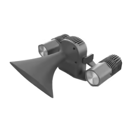

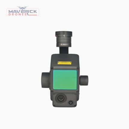
3D Mapping & Modular Autonomy LiDAR Payload
Specifications:
Map Accuracy: ±5 mm
Points Per Second: ~2,000,000
Megapixels: 3.2 MP
Horizontal Field of View: 360°
Flight Time: 20+ minutes
And many more…
- 7 Days Return, Exchange & Refund Policy.
- Free Delivery within 3 to 5 Days.
- Assured Product Quality. We deals with only Genuine Products.
- Peace of mind Warranty. Check Our Warranty Policy.
- Contact Us for Any Assistance.
Guaranteed Safe Checkout
Revolutionize Data Collection With The Drone 3D Mapping & Modular Autonomy LiDAR Payload
The 3D Mapping & Modular Autonomy LiDAR Payload is a game-changer in the world of Drone 3D Mapping, offering unparalleled accuracy, speed, and flexibility for a wide range of applications. Designed with advanced SLAM-based spatial mapping technology, this LiDAR system ensures that every detail is captured with precision, making this Drone LiDAR Scanner an essential tool for professionals in surveying, construction, urban planning, and more.
Are You Looking For The Best LiDAR Drone? If So, Get In Touch With Our Sales Team Right Now.
Drone 3D Mapping: Key Specifications
- Map Accuracy: ±5 mm
- Points Per Second: ~2,000,000
- Megapixels: 3.2 MP
- Horizontal Field of View: 360°
- Flight Time: 20+ minutes
- Design: Modular, allowing for customizable configurations
- Smart Collision Avoidance: Enhances operational safety
Drone 3D Mapping: Speed, Accuracy, And Reliability
When it comes to capturing data, the Drone 3D Mapping & Modular Autonomy LiDAR Payload doesn't disappoint. Its ability to generate up to 2 million scan points per second ensures that even the most intricate details are recorded with survey-grade accuracy of up to 5 mm at 1 sigma. This high level of precision is crucial for creating reliable 3D models, making this LiDAR Camera For Drone a top choice for professionals requiring detailed spatial data.
Are You Looking For The Best LiDAR Drone? If So, Get In Touch With Our Sales Team Right Now.
Drone 3D Mapping: Versatile Compatibility With Matrice Series Drones
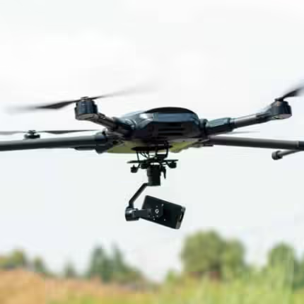
The Drone 3D Mapping & Modular Autonomy LiDAR Payload is engineered for seamless integration with DJI's Matrice series drones, including models like the Matrice 200, 300, and 600. The compatibility with these powerful UAVs means that users can easily mount and operate this LiDAR Camera For Drone to maximize its data collection capabilities. The modular design also allows users to customize the payload according to their specific needs, making it versatile across different industries and applications.
Are You Looking For The Best LiDAR Drone? If So, Get In Touch With Our Sales Team Right Now.
The Matrice series' advanced flight control systems, extended flight times, and robust build quality further enhance the functionality of the Drone 3D Mapping & Modular Autonomy LiDAR Payload. Whether conducting detailed surveys in urban environments or remote terrains, this system ensures high-quality data capture with minimal downtime. This product is highly useful for detailed LiDAR Drone Survey.
Drone 3D Mapping: Industry-Wide Applications
The Drone 3D Mapping & Modular Autonomy LiDAR Payload is not just for one specific industry; its utility spans across multiple sectors. In construction, it enables precise monitoring of site progress and helps in the creation of accurate as-built models. In urban planning, this LiDAR 3D Mapping system assists in the detailed mapping of cityscapes, providing crucial data for infrastructure development. Environmental monitoring, forestry management, and even disaster response operations benefit from the system’s ability to produce high-resolution 3D maps that aid in decision-making and planning.
Are You Looking For The Best LiDAR Drone? If So, Get In Touch With Our Sales Team Right Now.
Drone 3D Mapping: Smart Design And Safety Features
The smart collision avoidance feature of this LiDAR payload ensures that your drone operations are not only efficient but also safe. By autonomously detecting and avoiding obstacles, this 3D Mapping LiDAR Camera system reduces the risk of crashes, allowing for uninterrupted data collection even in challenging environments.
Are You Looking For The Best LiDAR Mapping Drone? If So, Get In Touch With Our Sales Team Right Now.
The 3D Mapping & Modular Autonomy LiDAR Payload is engineered for flawless compatibility with DJI's Matrice series drones, including the Matrice 200, 300, and 600 models. These drones are known for their robust performance, extended flight times, and advanced flight control systems, making them ideal platforms for this LiDAR payload. By integrating seamlessly with the Matrice series, the Drone 3D Mapping & Modular Autonomy LiDAR Payload leverages the drones' powerful features to deliver precise 3D mapping and spatial data collection.
Are You Looking For The Best LiDAR Drone? If So, Get In Touch With Our Sales Team Right Now.
The Matrice drones' versatility allows the Drone 3D Mapping & Modular Autonomy LiDAR Payload to be used across various industries, from construction and urban planning to environmental monitoring and disaster response. Additionally, the modular design of this LiDAR On A Drone ensures that it can be easily adapted or upgraded to meet specific project needs, further enhancing its utility when paired with the Matrice series. This synergy between the LiDAR system and the Matrice drones not only boosts operational efficiency but also ensures that users can tackle complex mapping tasks with confidence and precision.
Are You Looking For The Best LiDAR Mapping Drone? If So, Get In Touch With Our Sales Team Right Now.
Integrating the Drone 3D Mapping & Modular Autonomy LiDAR Payload with the DJI Matrice series opens up a world of possibilities for advanced aerial surveying and data collection. The Matrice drones are equipped with powerful flight control systems, multiple sensor compatibility, and superior stability, making them ideal for carrying this LiDAR 3D Mapping system. This integration ensures that the high precision and accuracy of the LiDAR system are fully utilized, providing detailed 3D maps and models with minimal errors. This product is highly useful for detailed LiDAR Drone Survey.
Are You Looking For The Best LiDAR Drone? If So, Get In Touch With Our Sales Team Right Now.
The compatibility with the Matrice series also enhances the ease of deployment in various environments. Whether you're working in dense urban areas, rugged terrains, or over large agricultural fields, the Matrice drones, combined with the Drone 3D Mapping & Modular Autonomy LiDAR Payload, can perform consistently under challenging conditions. The drones' ability to operate in harsh weather and their long flight times mean that LiDAR On A Drone can cover more ground in a single flight, making large-scale mapping projects more efficient and cost-effective.
Furthermore, the modular design of the Drone 3D Mapping & Modular Autonomy LiDAR Payload allows it to be customized to meet the specific requirements of different industries. This flexibility is particularly beneficial when paired with the Matrice drones, as it enables users to switch between different sensors and payloads quickly, adapting to the needs of each mission. This adaptability ensures that LiDAR On A Drone remains a valuable tool across diverse applications, from topographic mapping and infrastructure inspection to forestry management and emergency response.
Are You Looking For The Best LiDAR Drone? If So, Get In Touch With Our Sales Team Right Now.
The seamless integration with the Matrice series also supports the use of advanced features such as smart collision avoidance and autonomous flight modes. These capabilities enhance the safety and reliability of the LiDAR mapping missions, allowing operators to focus on data collection without worrying about potential obstacles or flight hazards. As a result, the combination of the Drone 3D Mapping & Modular Autonomy LiDAR Payload and Matrice drones not only improves operational efficiency but also ensures the highest level of data accuracy and safety, making it a top choice for professionals across various sectors.
Drone 3D Mapping: Hurry Up! Place Your Order Now!
The Drone 3D Mapping & Modular Autonomy LiDAR Payload is the perfect blend of speed, accuracy, and reliability, making it an indispensable tool for professionals who require high-quality 3D mapping. This LiDAR On A Drone’s seamless compatibility with DJI Matrice series drones, coupled with its modular design and smart safety features, make it a versatile and powerful addition to any drone fleet. Whether you’re mapping large construction sites, surveying remote landscapes, or capturing detailed urban data, this LiDAR system ensures that you get the most accurate and reliable results every time.
1. We ship our products all over India within 3-5 working days. This includes all 28 states and 8 Union Territories. We do not offer international shipping at this time. We apologize for any inconvenience caused.
2. We ship our products through our delivery partner Shree Tirupati Courier Services PVT. LTD . (http://www.shreetirupaticourier.net/ ) and DTDC Express LTD. (https://www.dtdc.in/index.asp). Shree Tirupati Courier has over 1500 centers in more than 21 states rest are covered by DTDC and its jargon of GPS-connected trucks.
Once we receive an order before 4 pm and we have received the payment at our bank we can process the order the very same day (if it’s a working day i.e. Monday to Saturday). If however, we receive it after 4 pm then we process the order the next working day.
3. As promised on our product page we will bear the entire charges of shipping to your location.
4. It takes around 3-5 working days to deliver the products anywhere in the country. They ship it via the above-mentioned couriers in the surface transit system. However, if you want a quicker delivery you can raise a request by getting in touch with us before placing the order(or within one hour of placing the order) through mail support@www.mavdrones.com or call us at +91 9330328517 We will arrange Air shipping in that case. You will receive the product within 1-3 working days in that case.
5. After shipping we will give you the tracking id within 2 hours of shipping. In case we ship through Shree Tirupati Courier then you can visit http://www.shreetirupaticourier.net/Frm_DocTrack.aspx?docno=%number% This page of them and put your tracking id and can get real-time updates through this tracking platform. However, if we ship through DTDC Express then you need to visit https://www.dtdc.in/tracking.asp for tracking shipping updates.
6. We have several options for sending you the tracking id i.e. we can send it in the mail, WhatsApp, or telegram.
7. If you have any problems with the delivery like:
7A. Delayed shipment: If the shipment is delayed by any chance of any more than 3-5 working days then you have the right to demand a full refund which will be processed as per our refund policy which you can see at our RETURNS< EXCHANGES AND REFUNDS POLICY or if you are willing to cooperate with us then we can enquire with the shipping company and try and find out why the delay is happening. In the latter case, we can either work with the shipping company and try and deliver the transiting item as soon as possible or we can ship a new product to your location through a different courier partner.
7B. Receiving a broken item: We strongly suggest you should make an unboxing video of the product and also keep recording till you successfully fly the drone. Therefore, if you receive a broken item we can identify it from the video and can process a RETURN, EXCHANGE, or Refund as per your wish.
8. Public Holidays and Force Majeure:
Please note that the delivery timeframe may be affected during public holidays and unforeseen circumstances beyond our control (Such as natural disasters, strikes, or transportation disruptions). We appreciate your understanding in such situations.
Related products
Micasense RedEdge-P – Multispectral Camera
In stock
₹1,239,000.00 Incl. GST. Claimable with B2B Billing.Inspired Flight Sentera 65R Payload for IF800
In stock
₹1,224,250.00 Incl. GST. Claimable with B2B Billing.DJI Zenmuse L1 Lidar- Versatile UAV Payload
In stock
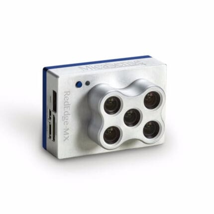
₹682,500.00 Incl. GST. Claimable with B2B Billing.Micasense RedEdge MX
In stock














Reviews
Clear filtersThere are no reviews yet.