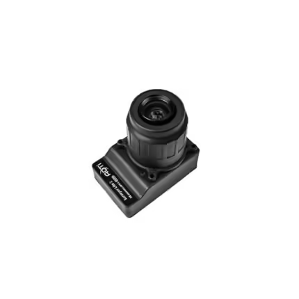
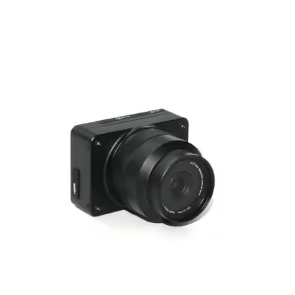
ADTi 26MP 26S V1 Surveyor Drone Mapping Cameras
₹147,949.58 – ₹186,416.40 Incl. GST. Claimable with B2B Billing.
Specifications:
Image Resolutions: 6192 x 4128 (26 MP), 4800 x 3200 (15.4 MP), 3680 x 2456 (9.0 MP), and 2400 x 1600 (3.8 MP).
Video Resolutions: 1920×1080 (60p), 640×480 (30p).
Image File Format: JPEG.
Video File Format: MP4.
HD Video Out: Yes, with an HDMI connection.
And many more…
- 7 Days Return, Exchange & Refund Policy.
- Free Delivery within 3 to 5 Days.
- Assured Product Quality. We deals with only Genuine Products.
- Peace of mind Warranty. Check Our Warranty Policy.
- Contact Us for Any Assistance.
Guaranteed Safe Checkout
ADTi 26MP 26S V1 Surveyor Drone Camera For Mapping For You
Introducing the ADTi 26MP 26S V1 Surveyor Drone Camera for mapping. This ADTi 26MP Surveyor Drone Mapping Camera is a compact, high-performance product. The USP of this product is that it comes with the latest mapping technology. This advanced 26MP APS-C drone mapping camera delivers exceptional image quality and precision. These ADTi 26S V1 Drone Mapping Cameras are a fantastic option. An excellent option for applications involving professional mapping as well as surveying.
ADTi 26MP 26S V1 Surveyor Drone Camera: Features That Are Important
Compact Design: This ADTi 26S V1 Surveyor Camera For Drones measures just 5.8 x 5.8 x 2.3 cm and weighs only 120 g. The ADTi 26MP 26S V1 is one of the most compact and lightweight mapping cameras available. It ensures minimal impact on your drone's payload. This 26MP ADTi 26S V1 Surveyor Drone Camera comes with a small footprint. A small footprint allows for easy integration with a variety of drone platforms. Thus making it a versatile choice for different surveying tasks.
High-Resolution Imaging: This 26MP ADTi Surveyor Drone Mapping Camera includes great features. Such as Sony IMX571 CMOS sensor and Socionext Imaging processor-Milbeaut®. This 26S V1 ADTi Surveyor Drone Camera captures stunningly detailed images. Detailed images will be in 26.1 megapixels, low heat up, and excellent color accuracy. The high-resolution sensor guarantees accurate recording of every detail. These 26S V1 ADTi Drone Mapping Cameras are hence perfect for applications. That requires detailed orthomosaics, 3D models, and precise topographic mapping.
Versatile Lens Options: Choose from two fixed lenses to match your mapping needs:
- 25mm Lens: Offers a 59° field of view (FOV) with a 37.5mm equivalent focal length and minimal distortion (<0.5%).
- 35mm Lens: Provides a 45° FOV with a 52mm equivalent focal length and extremely low distortion (<0.02%).
Advanced Imaging Technology: This ADTi Surveyor Drone Camera 26MP 26S V1 features a mechanical shutter. This ADTi Surveyor Drone Camera 26MP 26S V1 also features fixed focus lenses. Ultimately ensuring sharp, high-quality images every time. These ADTi 26MP Mapping Cameras For Surveyor Drones also include a built-in Multi-Interface hot shoe output. For precise PPK (Post-Processing Kinematic) geotagging, with optional direct geotagging functionality. This advanced imaging technology makes ADTi 26S V1 26MP Drone Mapping Camera an excellent choice. An excellent choice for professionals needing high accuracy in their geospatial data.
Robust Build: This product is constructed using a full aluminum structure. The ADTi 26MP 26S V1 Surveyor Drone Camera for mapping withstands the rigors of fieldwork. While maintaining durability and reliability. This Surveyor Drone Camera ADTi 26MP 26S V1’s robust build ensures that it can endure the harsh conditions that are often encountered in surveying environments. Thus providing peace of mind that the camera will perform reliably regardless of the situation.
ADTi 26MP 26S V1 Surveyor Drone Camera: Image And Video Specifications
- Image Resolutions: 6192 x 4128 (26 MP), 4800 x 3200 (15.4 MP), 3680 x 2456 (9.0 MP), and 2400 x 1600 (3.8 MP).
- Video Resolutions: 1920x1080 (60p), 640x480 (30p).
- Image File Format: JPEG.
- Video File Format: MP4.
- HD Video Out: Yes, with an HDMI connection.
Operating Conditions: These Mapping Cameras For ADTi 26MP 26S V1 Drone operate efficiently within a temperature range of -10 to 40°C. This product is powered by a 12-24V DC LiPo or Li-ion battery. This broad operating range ensures this camera can be used in various environmental conditions. Thus, making it suitable for use in both extreme cold and heat.
Dimensions and Weight: This ADTi 26MP 26S V1 Drone Surveying Camera measures 5.8 x 5.8 x 2.3 cm. It also weighs 71g without the case or 122g with the aluminum case. It comes packaged in a 14.5 x 10 x 6 cm box, weighing 500 g. The compact and lightweight design makes it easy to transport and handle. Thus, ensuring convenience during field operations.
Enhanced Connectivity: The ADTi 26MP 26S V1 Surveyor Drone Camera includes multiple connectivity options. That includes a built-in HDMI port for real-time video output and a USB for quick data transfer. These features enable seamless integration with ground control stations and other surveying equipment. Thus enhancing workflow efficiency.
User-Friendly Interface: This 26MP ADTi 26S V1 Drone Camera For Mapping boasts an intuitive user interface. Thus making it easy for operators to configure settings and operate this 26MP ADTi 26S V1 Surveyor Drone Camera. The interface is designed to streamline the surveying process. Thus reducing the learning curve and enabling users to focus on data collection.
Versatile Application: The ADTi 26MP 26S V1 is not limited to traditional surveying. Its high-resolution imaging and robust build make it suitable for various applications. That includes agriculture, environmental monitoring, and infrastructure inspection. This 26S V1 ADTi Surveyor Drone Camera's adaptability feature meets diverse industrial needs.
ADTi 26MP 26S V1 Surveyor Drone Camera: Purchase This Product Now
ADTi 26MP 26S V1 Surveyor Drone Camera combines the latest technology with a compact design. To provide superior performance for drone-based mapping and surveying. Enhance your aerial data collection task today. Buy and start using this best mapping ADTi Surveyor Drone Camera 26MP 26S V1. This camera is engineered for precision in various surveying applications. You might be into mapping agricultural fields, monitoring environmental changes, or inspecting infrastructure. Choose and buy this product today. This ADTi 26MP 26S V1 delivers the accuracy and detail you need to make informed decisions.
| Lens Type Select the Lens Type from the list below |
16mm ,25mm ,35mm |
|---|
1. We ship our products all over India within 3-5 working days. This includes all 28 states and 8 Union Territories. We do not offer international shipping at this time. We apologize for any inconvenience caused.
2. We ship our products through our delivery partner Shree Tirupati Courier Services PVT. LTD . (http://www.shreetirupaticourier.net/ ) and DTDC Express LTD. (https://www.dtdc.in/index.asp). Shree Tirupati Courier has over 1500 centers in more than 21 states rest are covered by DTDC and its jargon of GPS-connected trucks.
Once we receive an order before 4 pm and we have received the payment at our bank we can process the order the very same day (if it’s a working day i.e. Monday to Saturday). If however, we receive it after 4 pm then we process the order the next working day.
3. As promised on our product page we will bear the entire charges of shipping to your location.
4. It takes around 3-5 working days to deliver the products anywhere in the country. They ship it via the above-mentioned couriers in the surface transit system. However, if you want a quicker delivery you can raise a request by getting in touch with us before placing the order(or within one hour of placing the order) through mail support@www.mavdrones.com or call us at +91 9330328517 We will arrange Air shipping in that case. You will receive the product within 1-3 working days in that case.
5. After shipping we will give you the tracking id within 2 hours of shipping. In case we ship through Shree Tirupati Courier then you can visit http://www.shreetirupaticourier.net/Frm_DocTrack.aspx?docno=%number% This page of them and put your tracking id and can get real-time updates through this tracking platform. However, if we ship through DTDC Express then you need to visit https://www.dtdc.in/tracking.asp for tracking shipping updates.
6. We have several options for sending you the tracking id i.e. we can send it in the mail, WhatsApp, or telegram.
7. If you have any problems with the delivery like:
7A. Delayed shipment: If the shipment is delayed by any chance of any more than 3-5 working days then you have the right to demand a full refund which will be processed as per our refund policy which you can see at our RETURNS< EXCHANGES AND REFUNDS POLICY or if you are willing to cooperate with us then we can enquire with the shipping company and try and find out why the delay is happening. In the latter case, we can either work with the shipping company and try and deliver the transiting item as soon as possible or we can ship a new product to your location through a different courier partner.
7B. Receiving a broken item: We strongly suggest you should make an unboxing video of the product and also keep recording till you successfully fly the drone. Therefore, if you receive a broken item we can identify it from the video and can process a RETURN, EXCHANGE, or Refund as per your wish.
8. Public Holidays and Force Majeure:
Please note that the delivery timeframe may be affected during public holidays and unforeseen circumstances beyond our control (Such as natural disasters, strikes, or transportation disruptions). We appreciate your understanding in such situations.
Related products
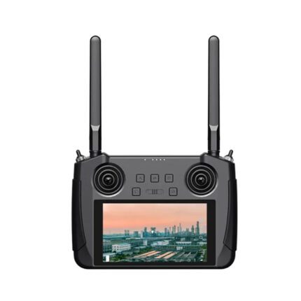
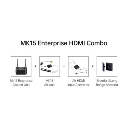
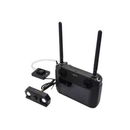
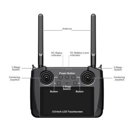
MK15 Mini Remote HD Smart Controller: HDMI COMBO
In stock
₹74,338.82 Incl. GST. Claimable with B2B Billing.Skydroid H12 Remote Controller Without Camera
In stock
₹41,888.82 Incl. GST. Claimable with B2B Billing.JIYI Obstacle Avoidance Radar For Agriculture Drone
In stock
₹20,058.82 Incl. GST. Claimable with B2B Billing.SIYI A2 Mini Ultra Wide Angle FPV Gimbal Single
In stock
₹15,338.82 Incl. GST. Claimable with B2B Billing.SIYI DK32 Air Unit 2.4G Receiver With Telemetry Control Compatible With DK32 Remote Controller
In stock
₹8,258.82 Incl. GST. Claimable with B2B Billing.Hobbywing X8 Propeller 3090 CCW Without Mount
In stock
₹1,532.82 Incl. GST. Claimable with B2B Billing.






Reviews
Clear filtersThere are no reviews yet.