GIS Mapping Survey: The Digital Revolution In Land Mapping

Table of Contents
Remember those old, crinkled maps that refused to fold back properly? Yeah, forget those. Today’s maps are smarter, sharper, and seriously powerful. With GIS Mapping Surveys, we’re not just looking at locations—we’re analyzing, predicting, and making big decisions. From designing futuristic cities to tracking environmental shifts and managing disasters, GIS is like the brainpower behind modern geography.
So, the next time you pull up a map, just know—it’s probably doing a whole lot more than showing you the nearest coffee shop!
What Is A GIS Mapping Survey?
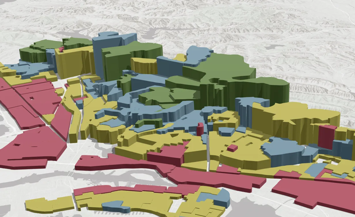
A GIS (Geographic Information System) mapping survey isn’t just about drawing maps—it’s about unlocking the secrets of the land through data. By collecting, analyzing, and visualizing geographical information, GIS creates interactive, multi-layered maps that go far beyond what traditional maps offer.
Instead of a simple static image, GIS maps are data-rich and dynamic, allowing users to study everything from terrain and infrastructure to population trends and environmental changes—all in real time. Whether planning cities, tracking wildlife, or predicting natural disasters, GIS makes geography smarter, faster, and more insightful than ever before.
How Does GIS Mapping Work?
The process of GIS mapping surveys involves:-
- Data Collection: Using satellites, drones, LiDAR, and ground-based surveys to gather geographical data.
- Data Processing: Organizing and cleaning raw data into meaningful layers.
- Analysis & Visualization: Using GIS software to create interactive maps with multiple data layers.
- Application & Decision Making: Governments, businesses, and researchers use these maps for planning, development, and problem-solving.
Industries That Rely On GIS Mapping
GIS mapping surveys are the backbone of numerous industries. Let’s take a look at a few sectors that thrive on their accuracy and efficiency:-
Urban Planning & Smart Cities
GIS helps city planners design infrastructure, optimize traffic flow, and monitor population growth. Cities like Singapore and Dubai use GIS extensively to create smart city solutions.
Environmental Conservation
From tracking deforestation to monitoring wildlife movements, GIS enables conservationists to make data-driven decisions for protecting nature.
Disaster Management
Before, during, and after disasters, GIS plays a critical role in mapping flood zones, identifying safe evacuation routes, and assessing damage.
Agriculture & Precision Farming
Modern farmers use GIS to monitor soil conditions, track crop health, and optimize irrigation systems—boosting productivity while reducing costs.
Real Estate & Infrastructure Development
Property developers and investors use GIS to assess land suitability, predict market trends, and plan construction projects effectively.
The Role Of Drones In GIS Mapping
Traditional surveying? A thing of the past. It was slow, labor-intensive, and downright exhausting. Enter drones—the game-changer in GIS mapping!
Armed with high-resolution cameras and LiDAR sensors, drones can capture vast geospatial data with pinpoint accuracy in no time. Surveyors can now generate 3D terrain models, analyze topography, and map large areas at lightning speed, all while slashing costs and improving efficiency. This isn’t just an upgrade; it’s a revolution in how we map the world!
The Future Of GIS Mapping
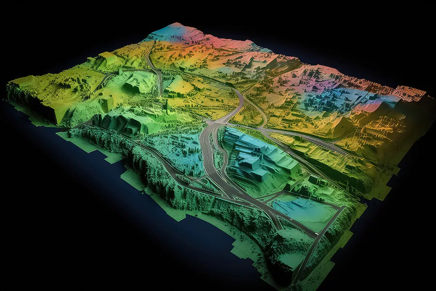
With advancements in AI, big data, and cloud computing, GIS mapping is becoming more powerful than ever. Future trends include:
Real-time GIS applications for instant updates and decision-making.
AI-powered spatial analysis to predict environmental changes and urban growth.
Augmented Reality (AR) GIS allows users to visualize geographical data in real-world environments.
Most Searched Questions About GIS Mapping Surveys
What is a GIS mapping survey?
A GIS mapping survey is the process of collecting, analyzing, and visualizing geographical data to create interactive digital maps.
What are the benefits of GIS mapping?
GIS mapping improves decision-making, enhances spatial analysis, boosts efficiency in planning, and provides real-time data insights.
How does GIS mapping work?
GIS mapping works by gathering geographical data from satellites, drones, and sensors, then processing it into layered, interactive maps.
What industries use GIS mapping?
Industries like urban planning, agriculture, disaster management, environmental conservation, and real estate rely on GIS mapping.
How accurate is GIS mapping?
GIS mapping can be highly accurate, especially using advanced tools like drones, LiDAR, and GPS-based data collection.
What is the difference between GIS and GPS?
GIS is a system for analyzing and visualizing spatial data, while GPS is a satellite-based system for pinpointing exact locations.
Can GIS mapping be done using drones?
Yes, drones equipped with high-resolution cameras and LiDAR sensors enhance the speed and accuracy of GIS mapping.
Is GIS mapping expensive?
Costs vary depending on the project, but advances in technology, such as drones and cloud-based GIS, have made it more affordable.
Conclusion On GIS Mapping Surveys
GIS mapping surveys have evolved beyond simple maps—they are now at the forefront of shaping our future. From designing smarter cities and predicting natural disasters to transforming farming practices, GIS has become the unsung hero of modern geography. As technology continues to advance, the power of GIS will only grow, redefining how we understand and interact with the world around us.
At Mavdrones, we harness the full potential of GIS mapping through advanced drone technology, helping industries unlock precise, real-time data for more intelligent decision-making. Ready to revolutionize your mapping? Let Mavdrones guide the way!
CEO, Mavdrones


